La Pinguica Site: Pictographs and Petroglyphs
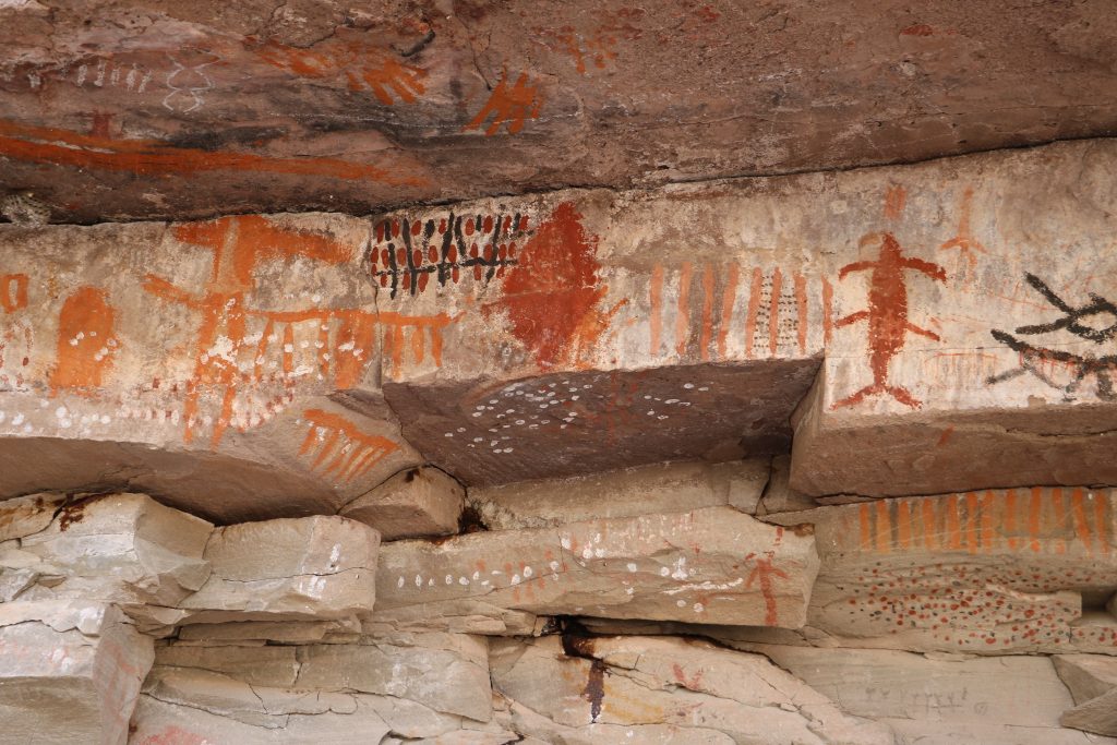
The La Pinguica site is a listed INAH site and has a spectacular display of Abstract pictographs in a multitude of colours. Some of the pictographs are tiny and extremely detailed. Some are larger and executed in seemingly random swishes. This is a site not to be missed! Don’t forget your camera!
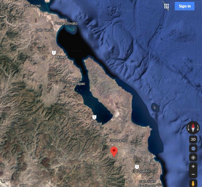
This snip of a Google Map shows the general location of La Pinguica relative to Mulege.
La Pinguica Pictographs and Petroglyphs
How to get there will be covered at the end of this article because I’ll bet you cant wait the see the art!
Petroglyphs First
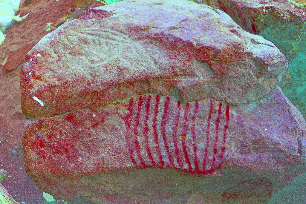
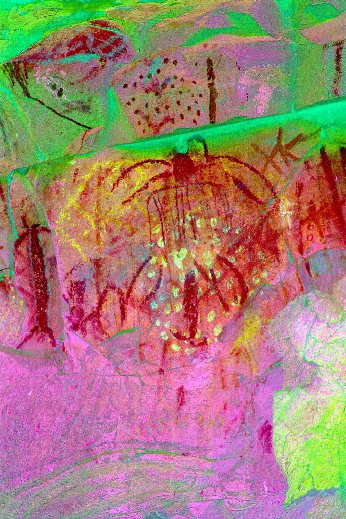
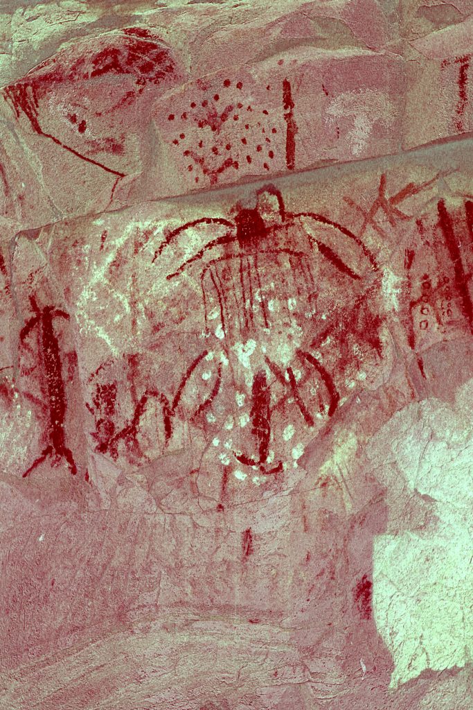
Most of the photos here were taken by Bruce and Marian Schweers. Thanks for the great images! Images are enhanced with Dstretch.
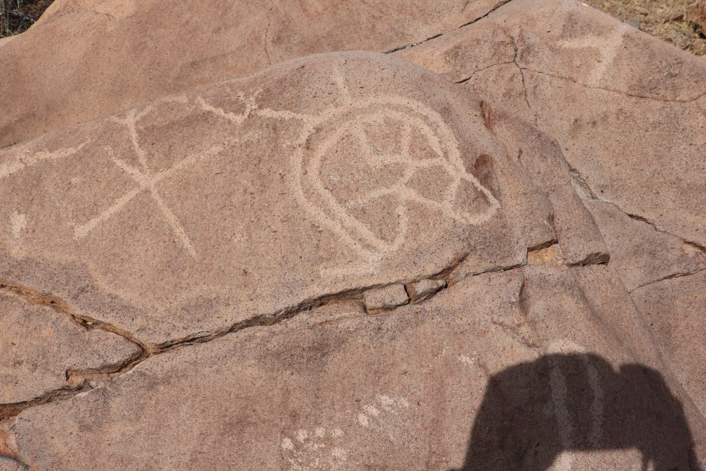
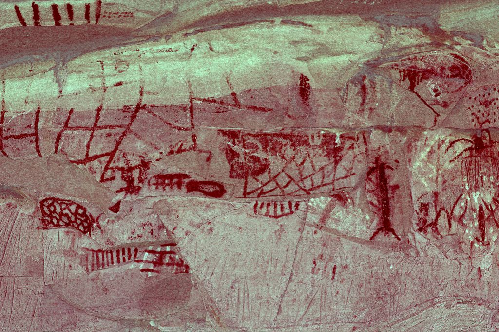
Most of the petroglyphs are on boulders on the right side of the arroyo.
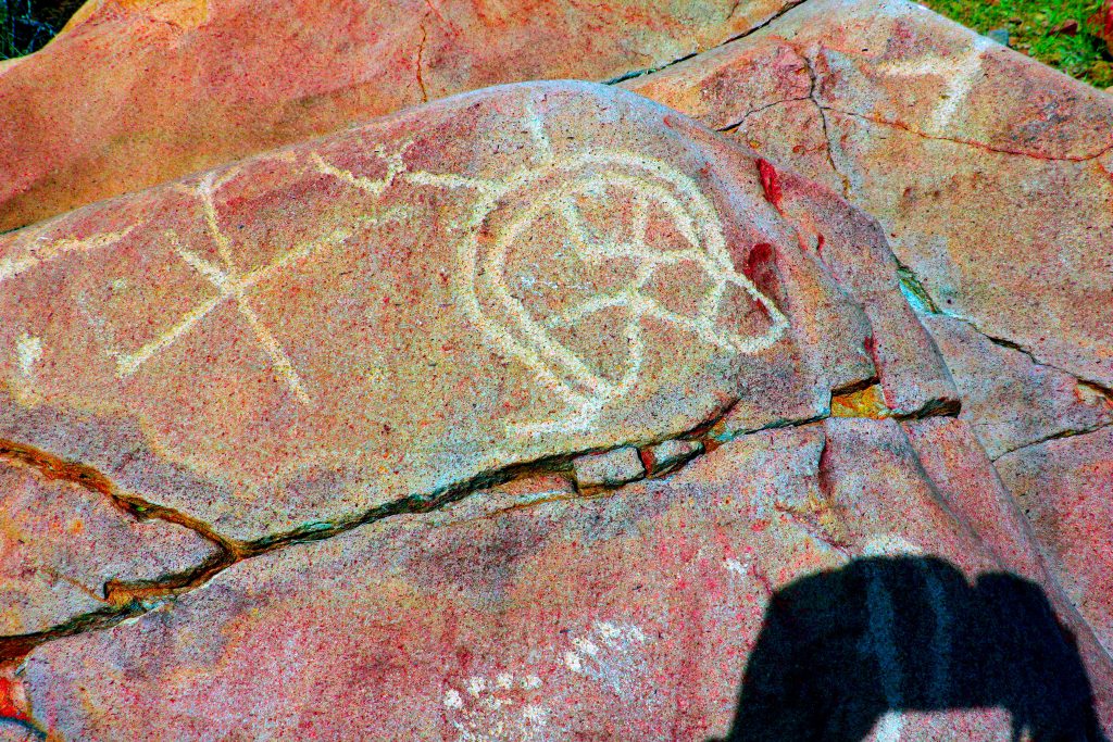
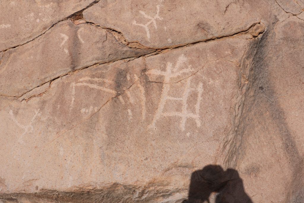
Could the image at center right be a stylized deer? Look at the feet.
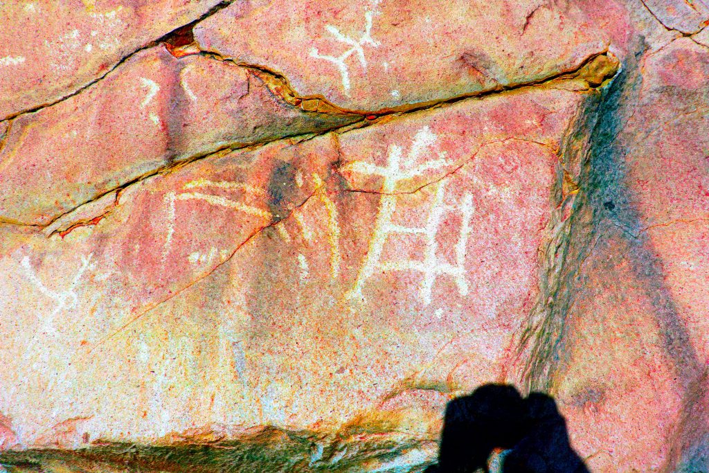
The snake is meandering over both planes of this boulder. What are the objects in front of the snake’s head?
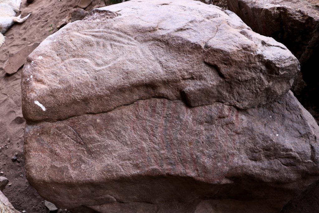
Snake on top of this boulder too. Fish is in ‘Ancient’ style. Other glyphs on lower level with multi-line pictograph
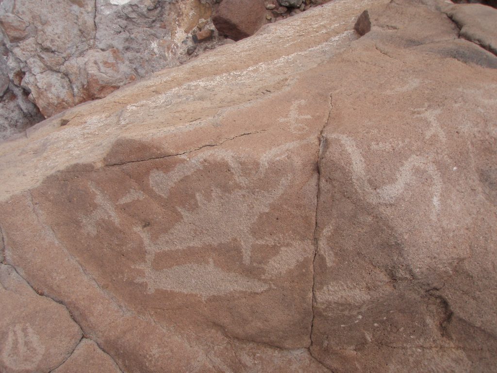
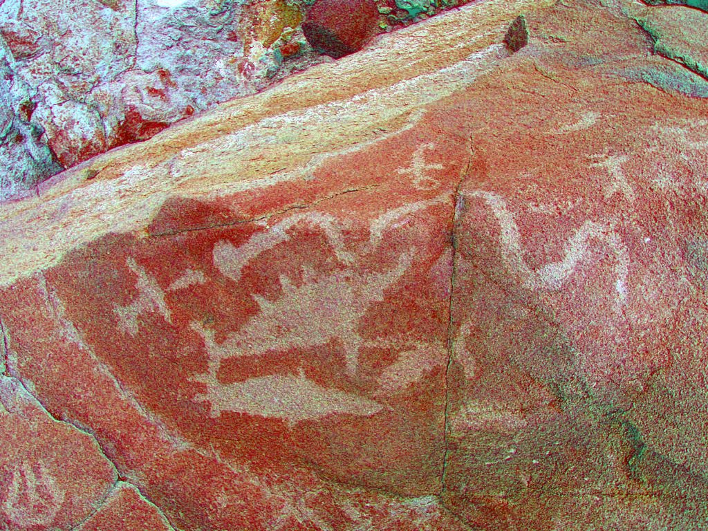
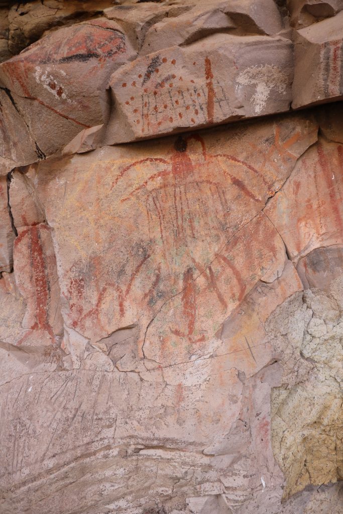
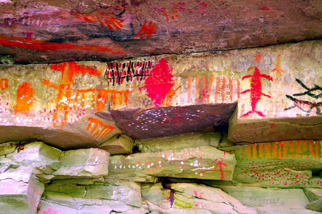
La Pinguica Pictographs
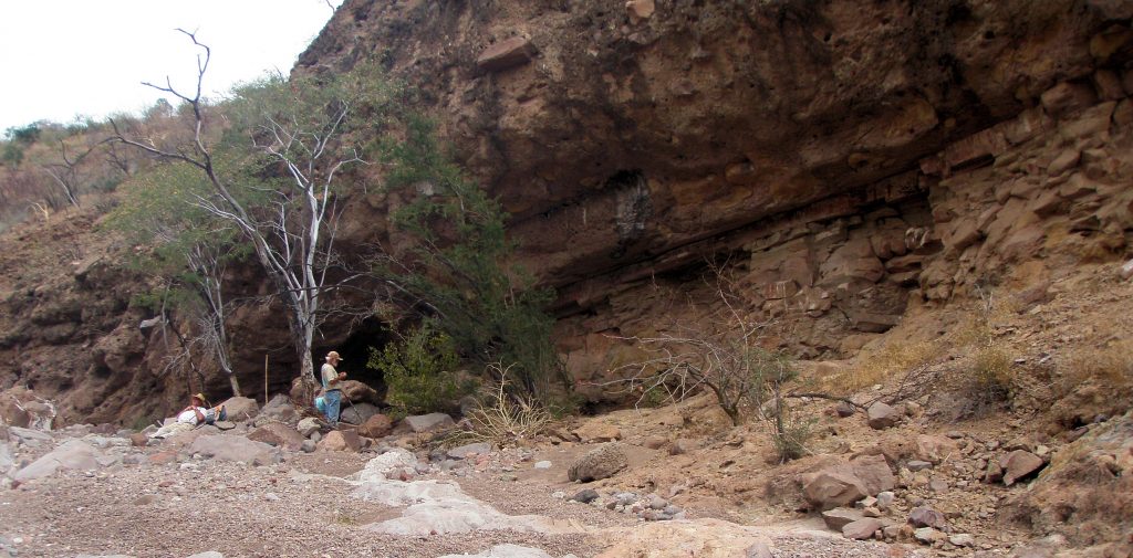
On the left side of the arroyo is this sloping rock face. All the pictographs are on the ledges underneath this sloping overhang. They are protected from sun and rain. . . . but not from vandals!
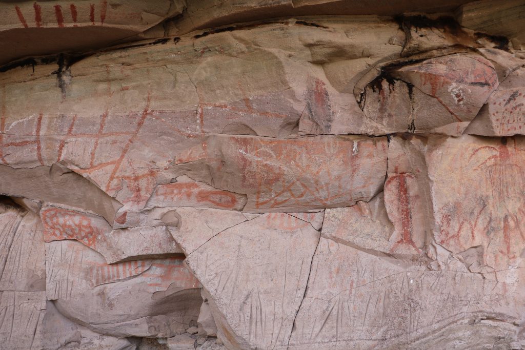
Above you can see multiple graphic elements. The lower panels show many linear grooves.
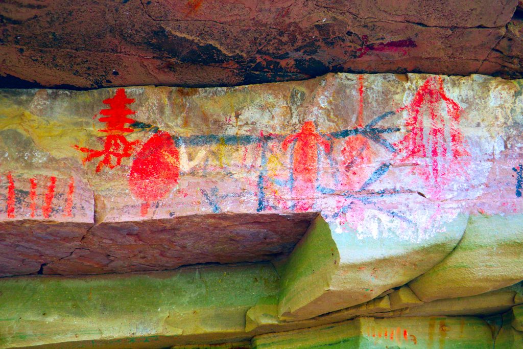
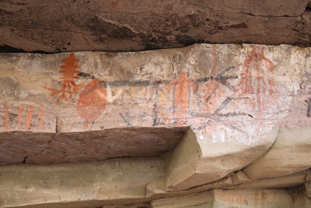
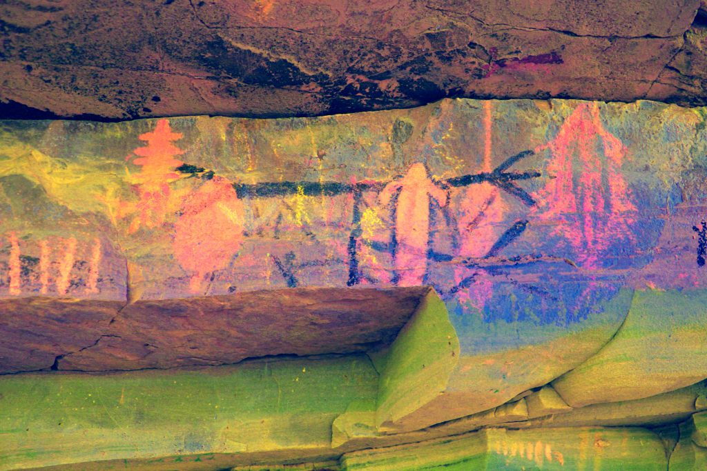
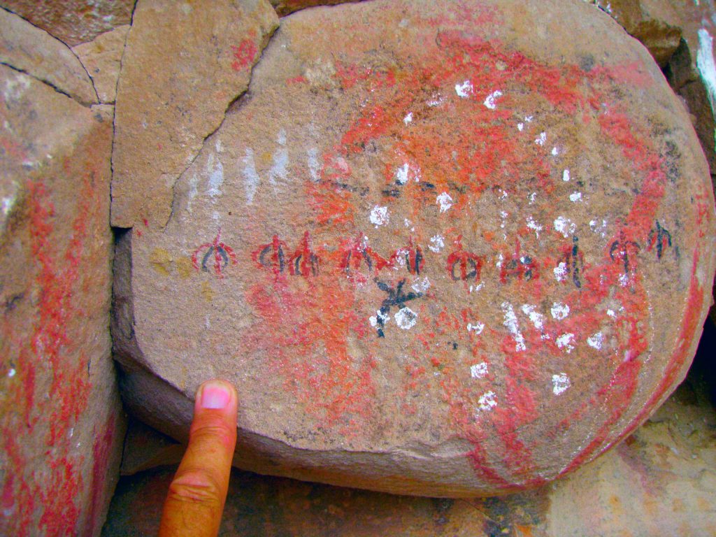
Tally Marks? Or the intellect striving towards a proto language?
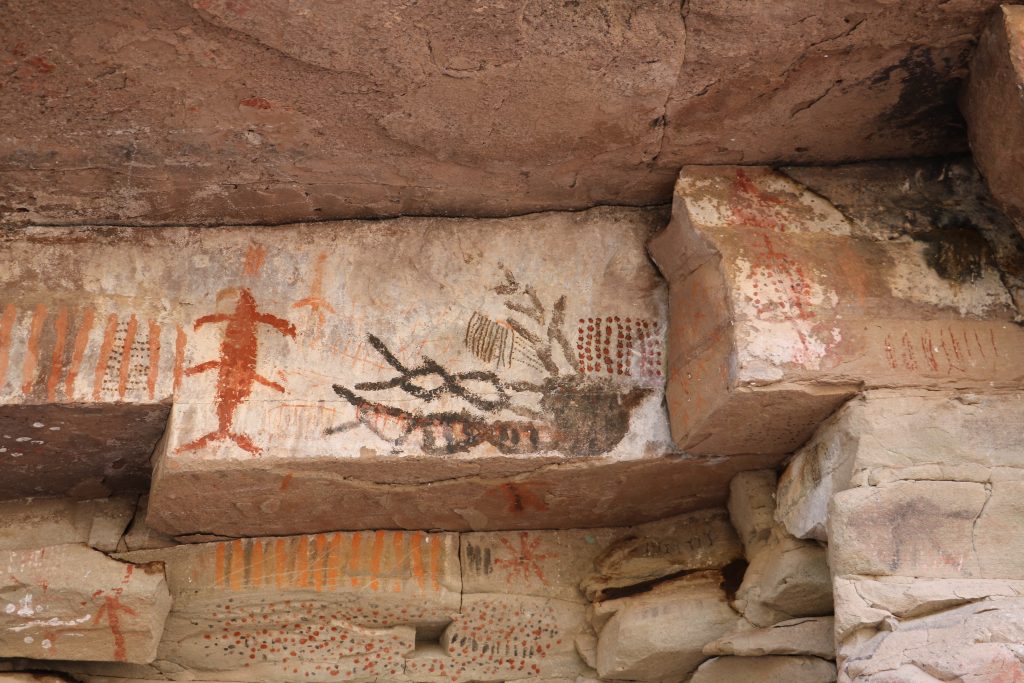
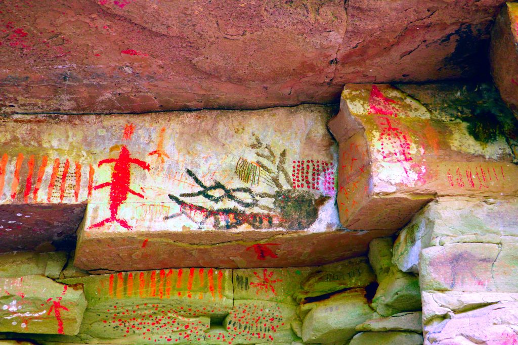
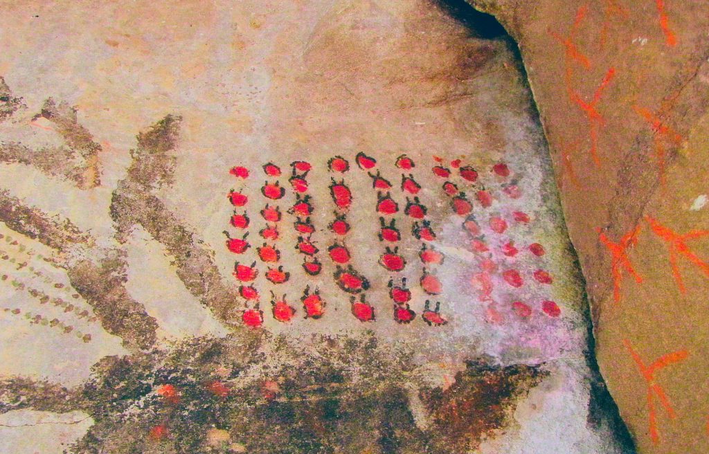
Maybe the artist was the precursor for The Rotten Tomato film critic and he has seen 52 good movies in a row? Hmm? My wife, Diane says they’re Ladybugs.
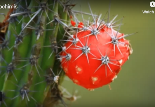
Or. . . the pictograph above may represent the Pitahaya cactus fruit?
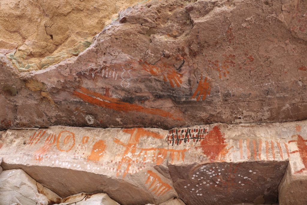
Positive hand prints on the overhead panel.
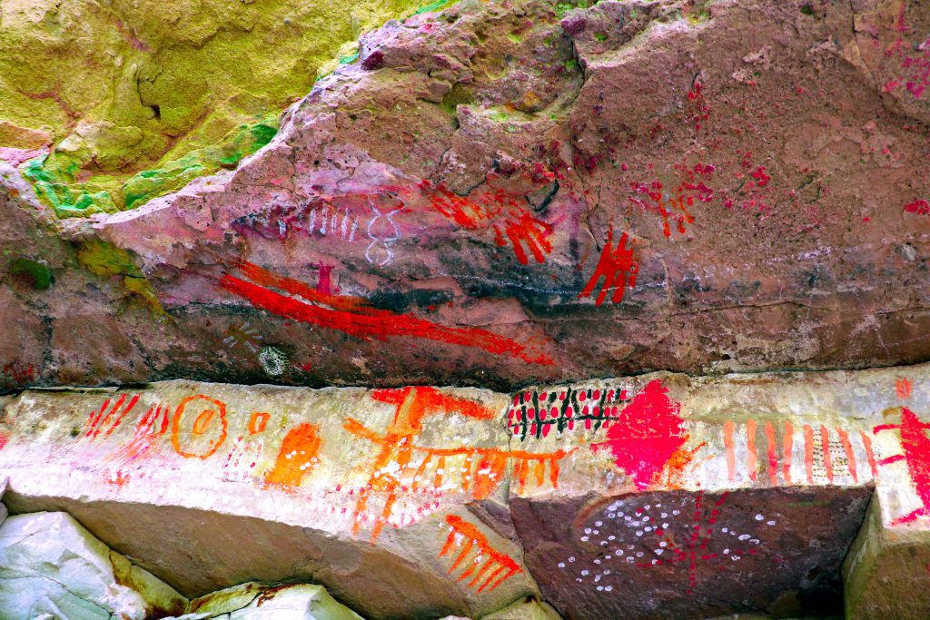
Very fine detail work. No, the white is not bird poop!
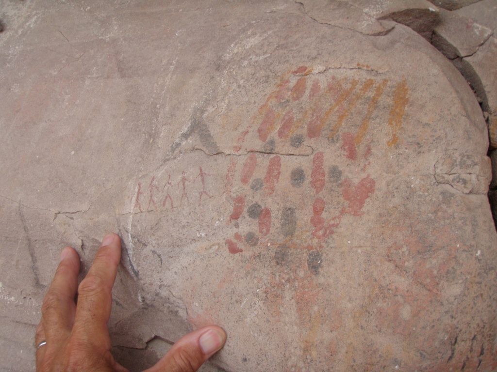
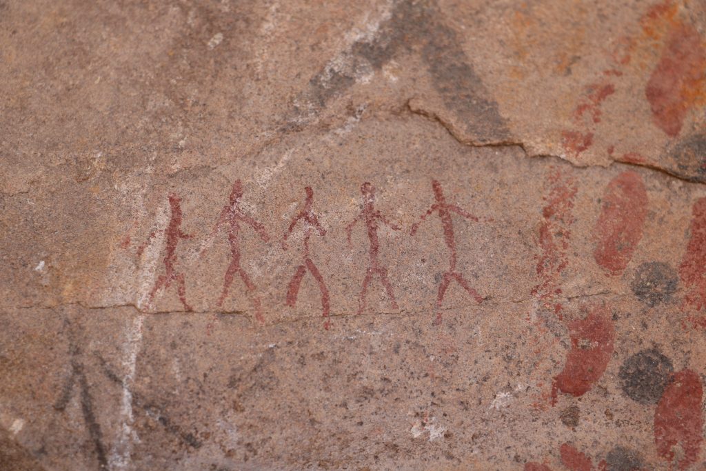
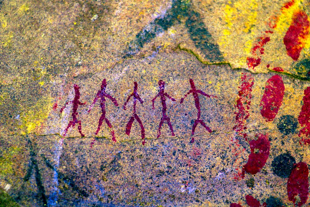
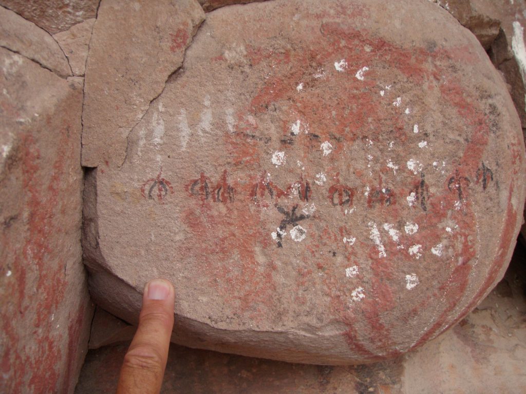
Above: Five little stick men about 3cms tall walking along a fissure in the rock. Bruce asked me . . . “Are these real, or are they present day graffiti?”
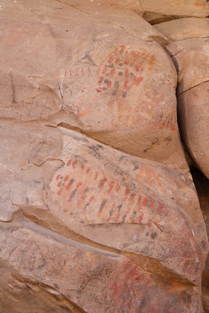
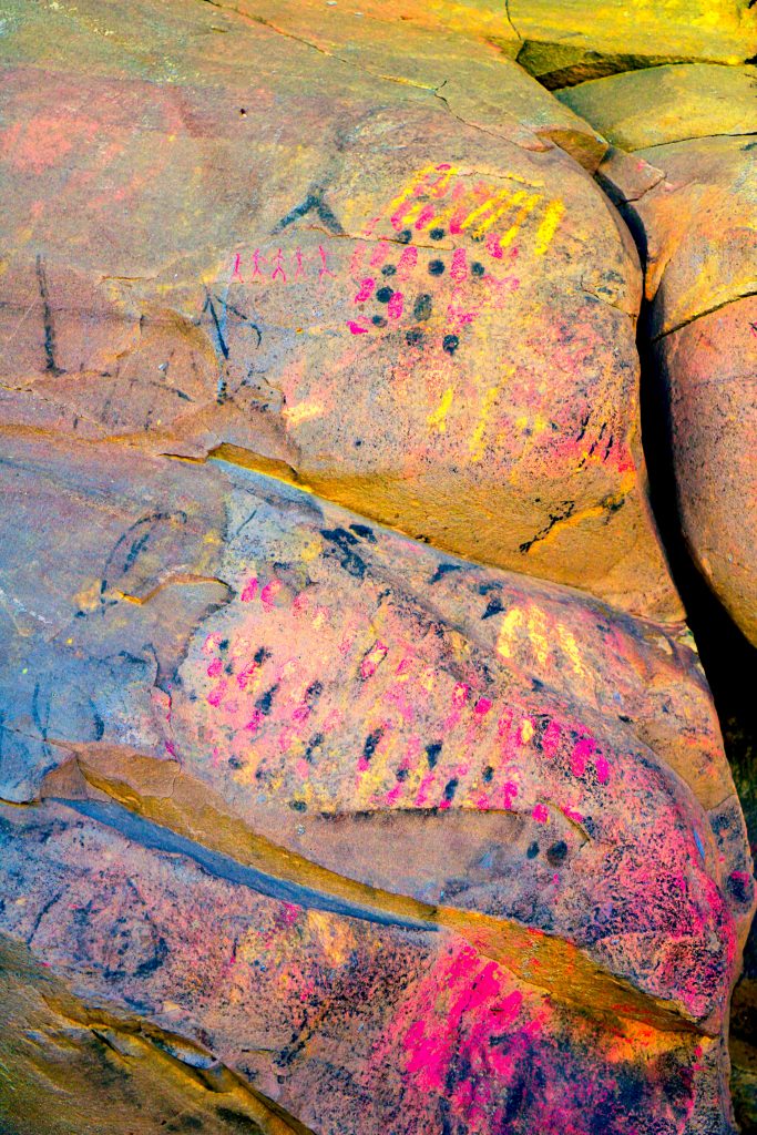
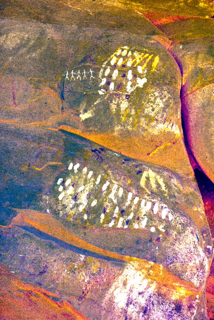
Above. Here’s the whole panel with the 5 stick men on the top. Different Dstretch enhancements with the original un-retouched at the top.
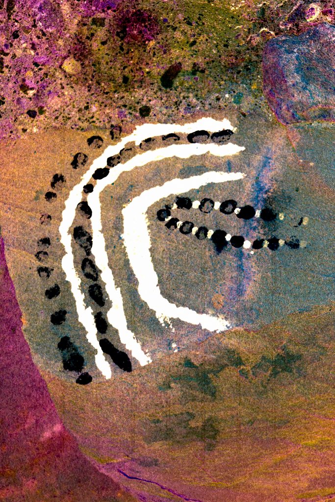
The colours on the left photo are un-retouched. . . GREEN is not a colour you’ll see often in Baja rock art. The subject matter is quite a complex rendition of relationships between lines and dots. Is this Art for Art’s Sake? Is a Phosphene being rendered?
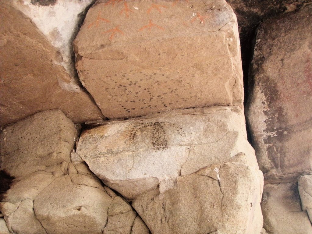
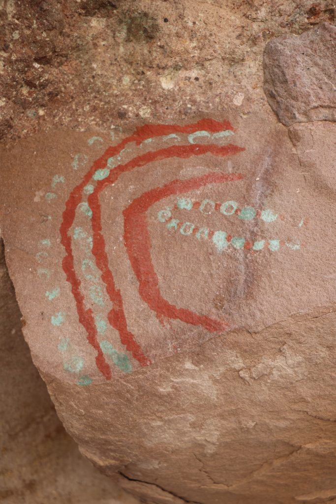
Looking up under this rock. . . . Does the net on the horizontal panel seem to engulf the ‘creature’ on the vertical panel below? How about the birds feet on the top panel?
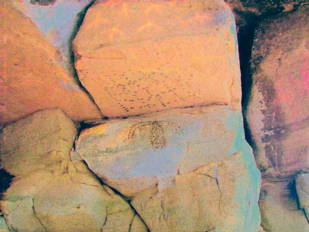
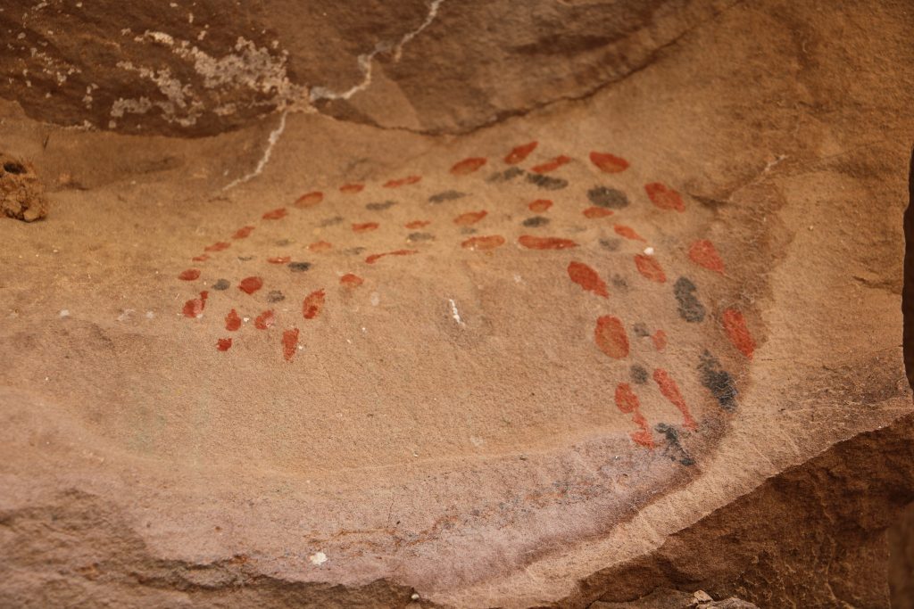
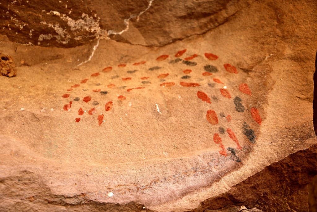
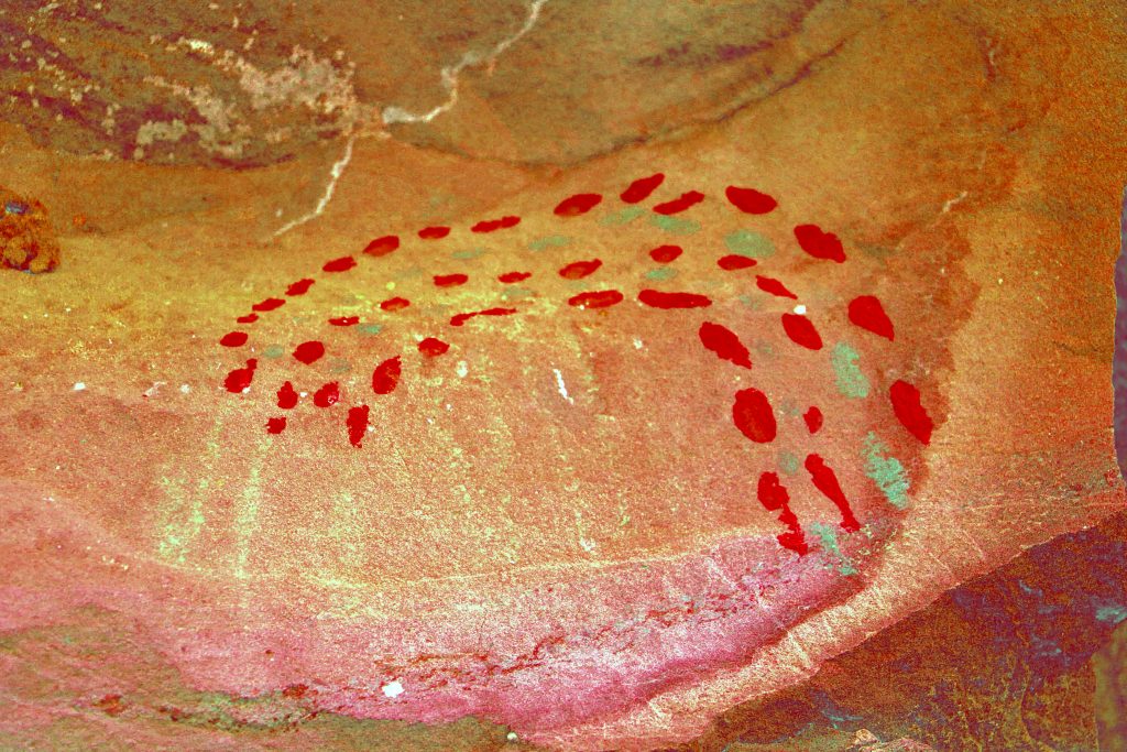
In the sequence above. The top photo is un-retouched. The bottom one has the contrast increased. The photo on the right is enhanced with DStretch, ac_yrd. (In the enhanced photo the black dots look green) The element is drawn on two planes of the rock face and there is the impression (faint lines) that the black and red dots were originally planned to continue down to the left to touch the rock fissure. Maybe the artist meant to come back and finish this but was called away. . . “Lunch time!”
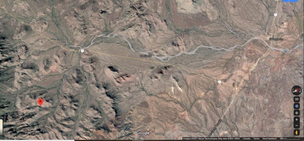
How to get to La Pinguica
If you visit this site, do so with a small group, maybe with two vehicles. Wear good shoes/boots and sun protection and don’t forget your water. It’s about 4km one way, on fairly soft sand and it will take about 2 hours to get there.
Directions:
Take Mex 1 south of Mulege towards Loreto. At about km 61 on Mex 1, take the dirt road going between Rosalita and La Purisma on the west coast. Go west on this road about 6.8km till you reach the first arroyo where there are concrete vados. This is the arroyo that will eventually reach San Nicholas on the coast. (see the San Nicholas Petroglyphs in this web site)
Turn left off the road into the arroyo (if you have 4×4, fine. If you don’t have a 4×4, park on the road but leave someone to watch the vehicle while you visit the site. ) Drive up the arroyo, heading south, till you cant go any more and park. Your vehicle will not be visible from the road here. This will be about 1/2km. from the road. GPS at this location may be close to: N26.39027, W 111.67847 elevation is about 210 meters.
Walk up the arroyo (south) about 1/2km till you get to a junction of 2 arroyos.
Take the right arroyo and walk up about 1.5km. N26.37725, W111.67211 elevation about 225 meters. At this point the arroyo swings to your right. If you look carefully on the left side of the arroyo at this point you’ll see an old road that heads south. Take this road (about 1/2km) as it is a short cut that cuts the corner of the arroyo which swings in a semi circle here.
Back on the arroyo again continue up (south) about 1 km where the arroyo again splits.
There is a large arroyo to the left, a large arroyo to the right and a smaller arroyo in the centre. Take the centre one which turns into a road again and follow it in dribs and drabs till you see the gate and sign for La Pinguica.
Once through the gate just follow the trail for about an additional 1 km and you’ll get to the dam.
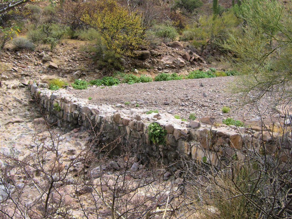
The pictograph site is about 100 meters up from the dam and on the opposite (left) side of the arroyo. N26.37xxx, W111.67xxx, elevation about 300 meters. The Petroglyphs are on this side of the arroyo.
Total distance walked is about 4kms one way and about 100 meters elevation gain.
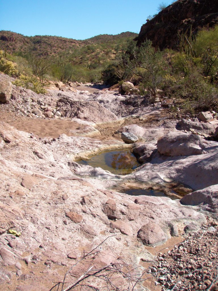
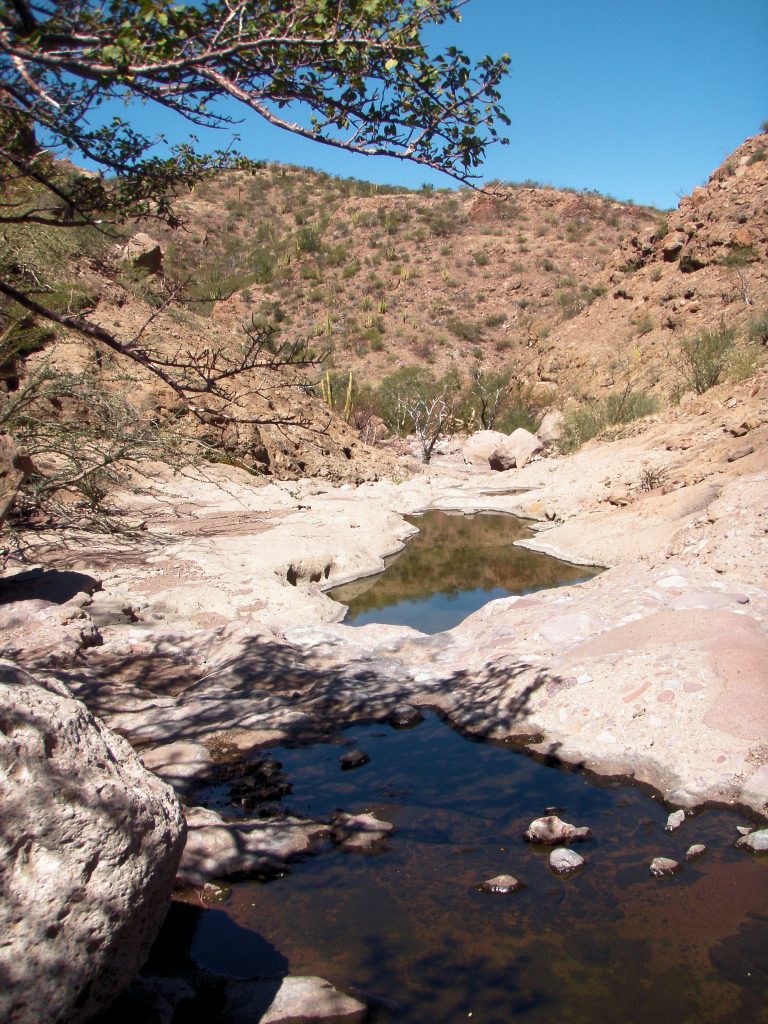
If you go past La Pinguica, further up the arroyo you’ll come across numerous pools in the bedrock, many of which held water at the time I saw them in March. The arroyo continues past these pools for about 2kms, the going gets rougher, and eventually reaches a dead end like a box canyon. No art was found past the Pinguica site.