4 RIGHT ARROYO
There is art in this arroyo
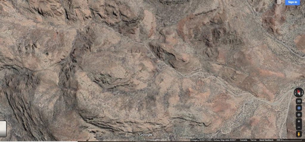
4 RIGHT starts at the same place as 3LEFT Near the large erratic boulders 3.8km from road at 26.704751,111.939350 Altitude is about 114 meters. Heads northwest. There is a trail visible in this arroyo in Google Earth.
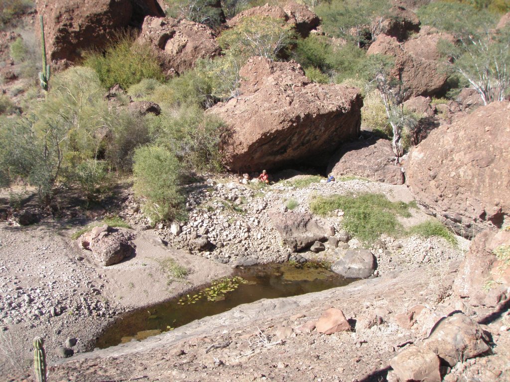
Large Pool in the center of the arroyo about 100 meters up from the junction. The Pool was holding water at time of travel in late February.
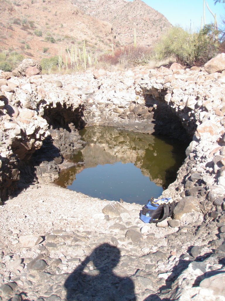
Pool is about 20 meters long and about 4 meters wide and is formed in a Calish base and must have a solid impermeable bottom. Upstream from the pool the arroyo is scoured fairly clean down to the Calish base with very few loose rocks and sand. This I believe will result in the pool remaining functional for many years without being silted up with rocks and sand. I am assuming that because of this, this pool existed in recent historic times and would have been there to benefit the Cochimi.
Two prominent Rock outcroppings on the left, north facing, at 0.6km from the junction and 26.708877, 111.944269 above a talus slope about 70 meters off the arroyo. There seems to be sign of zigzag trail to the north of the talus slope leading to the rocks. There is a third outcropping near the top of the slope at this point.
Wash to the right at 26.70938, 111.94437 altitude 124 meters. No exploring was done in this wash?
At about 1.1km from the start of this part of the arroyo and 26.71xxx, 111.94xxx there are a cluster of large erratic boulders exactly at the foot of a Draw/Wash to the left with fairly dense clusters of trees and cactus. The higher reaches of this wash was not explored.
The canyon in this part of the arroyo narrows significantly and the sides become rocky and very steep.
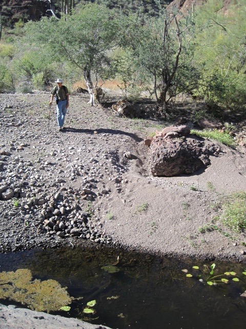
Here in this part of the main arroyo there is another pool, smaller than the one lower down the arroyo, about 5 meters by 2 meters that is holding water when visited in February. The water in this pool was significantly cleaner than the pool further south and has water lilies and other aquatic plants. Birds and insects were present and tracks of other animals indicate varied usage. Normally, I would not consider drinking from standing water pools in any of the arroyos I’ve visited. If I was in need, I would consider this particular source. For such situations, I carry a Lifestraw brand water filter.
Photo by B Schweers
Venado Gordo site: Comprises Various art locations in the immediate area.
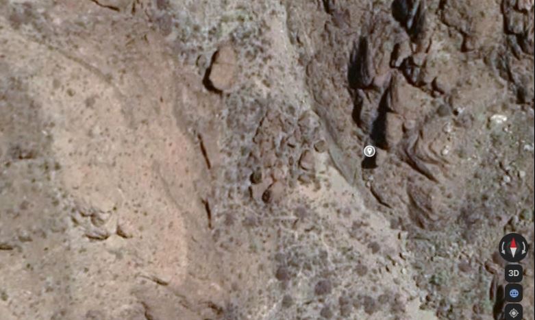
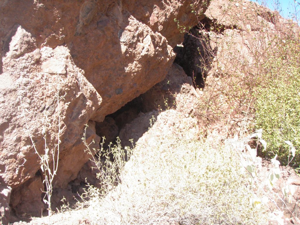
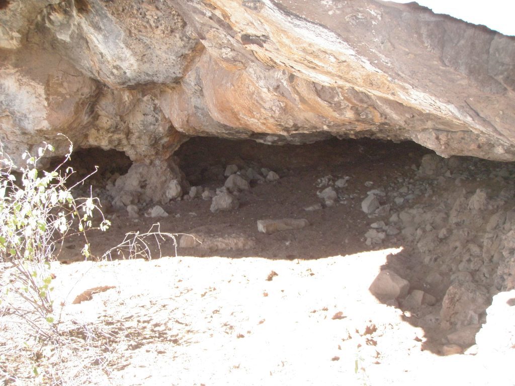
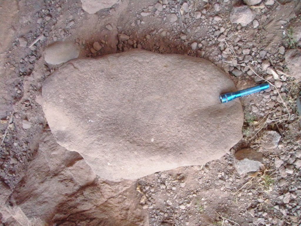
Cave SB 4R C1 26.71xxx, 111.94xxx altitude 144 meters. This is a shelter formed by large house sized rocks leaning on one another. The floor of this shelter is only about 1 meter above the water level at full pool, about 9 meters to the left (west) of the pool, and is open to the east facing the pool. The shelter is about 7 meters wide, 2 meters deep and 3-5 meters high at its highest tapering down to ground level at the back of the shelter.
Marian Schweers at left of shelter in this photo by author
There is evidence of high water from the arroyo washing through the bottom of this shelter and this probably removed artifacts like metates as none were found. The sloping roof of this shelter has the pictographs. The roof has blackened surfaces from fires and many of the pictures are covered or partially covered with a sooty residue.
Pictographs of note are:
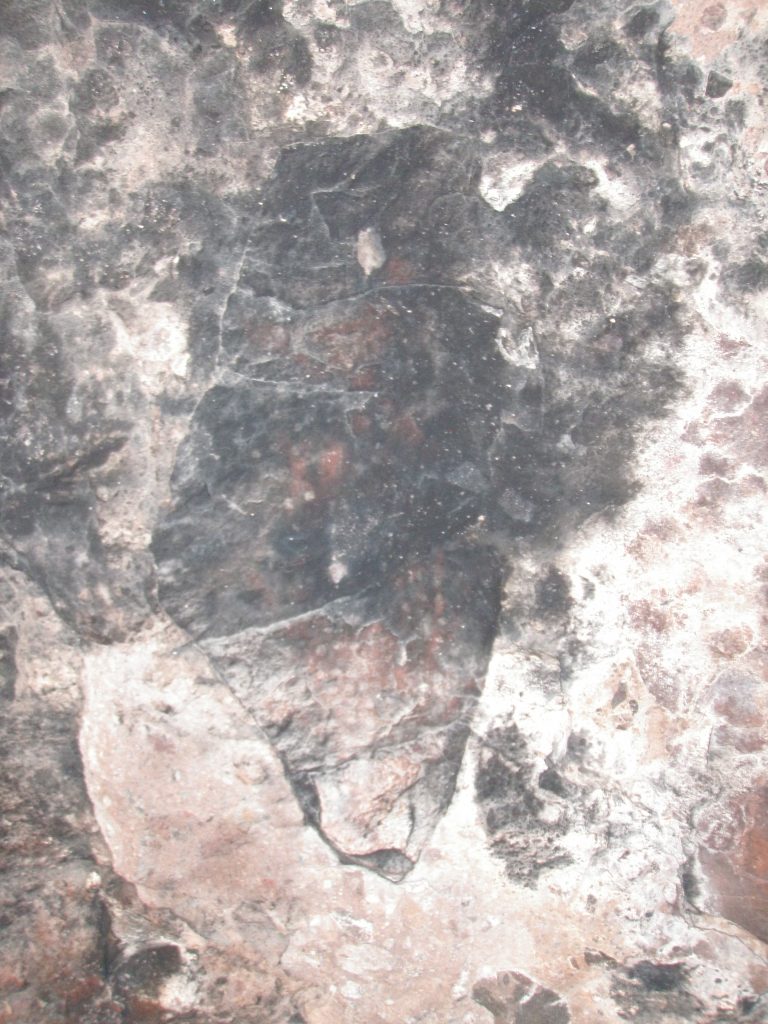
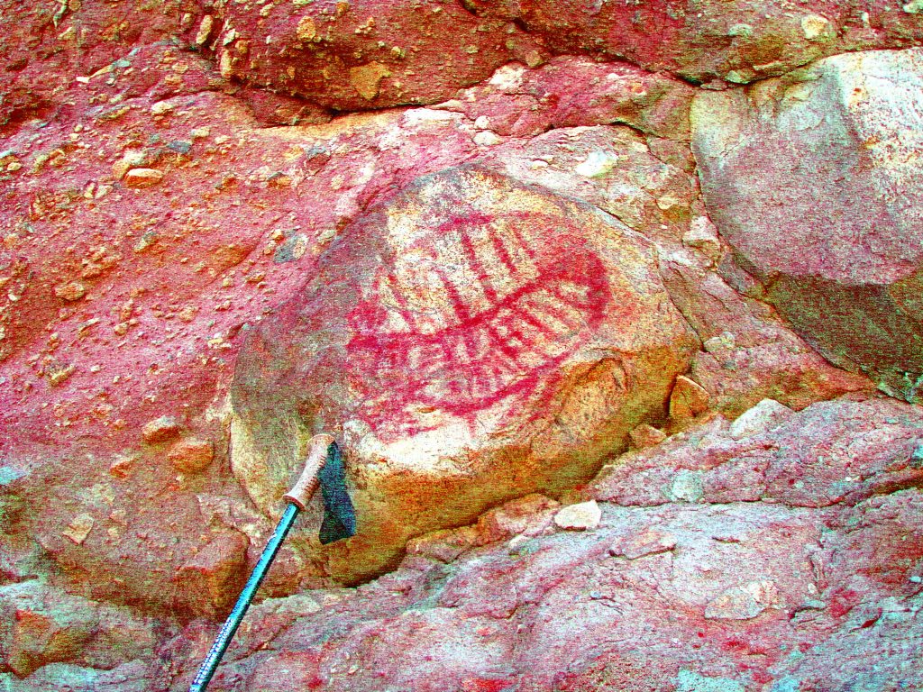
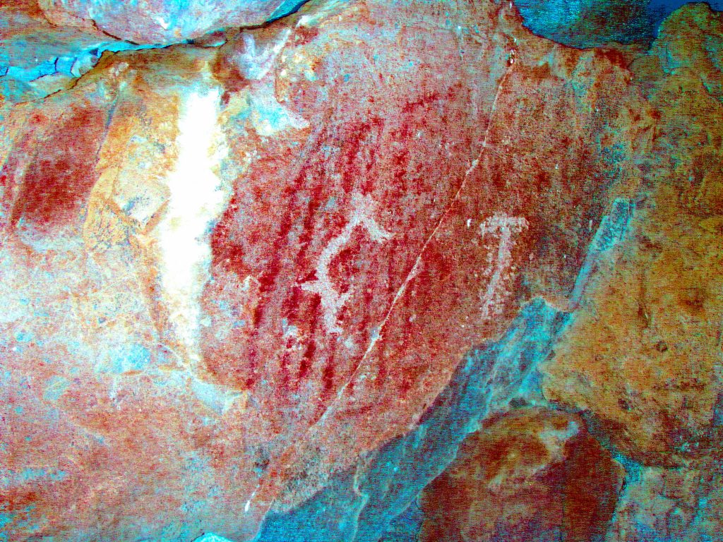
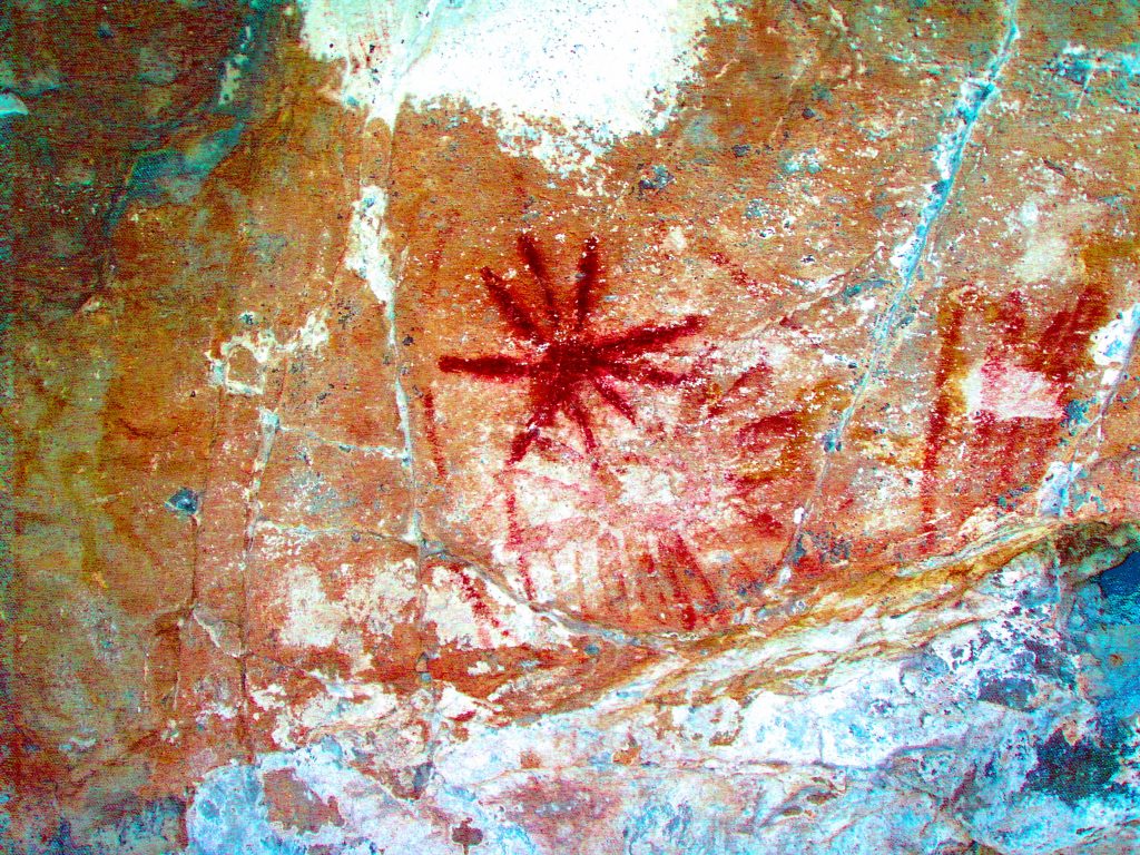
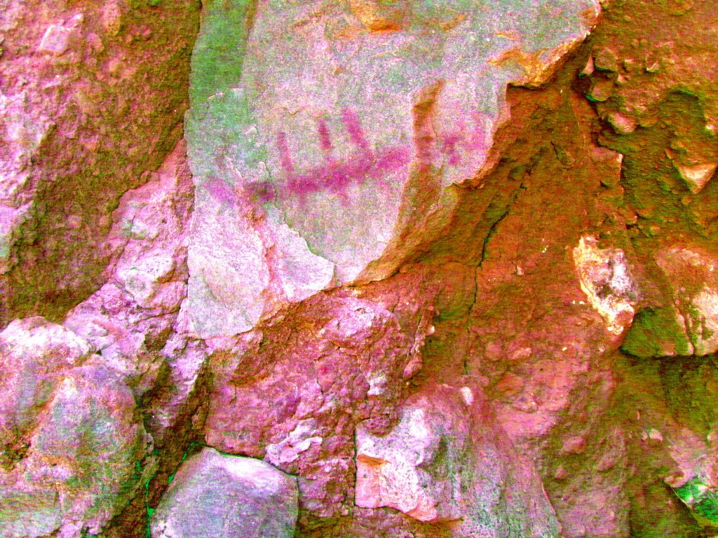
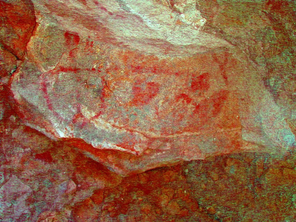
Figure 1. Whale Shark.
Figure on the right side of the shelter in red and black of a aquatic creature partially blackened with smoke, about 25cm high and 10cm wide with the tail up. The head of the figure also is “Incorporated” into a black triangular shaped piece of the rock face with the point facing down and the head of the figure positioned close to the point of the rock. Most noticeable with this figure however, is that it has white, perfect circles between 7 – 12mm in diameter randomly applied over the whole surface. This could make the picture similar to the spotted skin of a whale shark. The surface colour of the figure is a very dark reddish black and in places seems also to be outlined in red.
Un-retouched photo showing Figure 1 by author
Note: The reddish black on the figure was definitely painted, and is not as a result of blackening from the fires because if the black in the figure was from the fires then the white circles would have been covered over and not visible. Therefore as the white circles are readily visible, you can conclude that they were applied after the figure was painted.
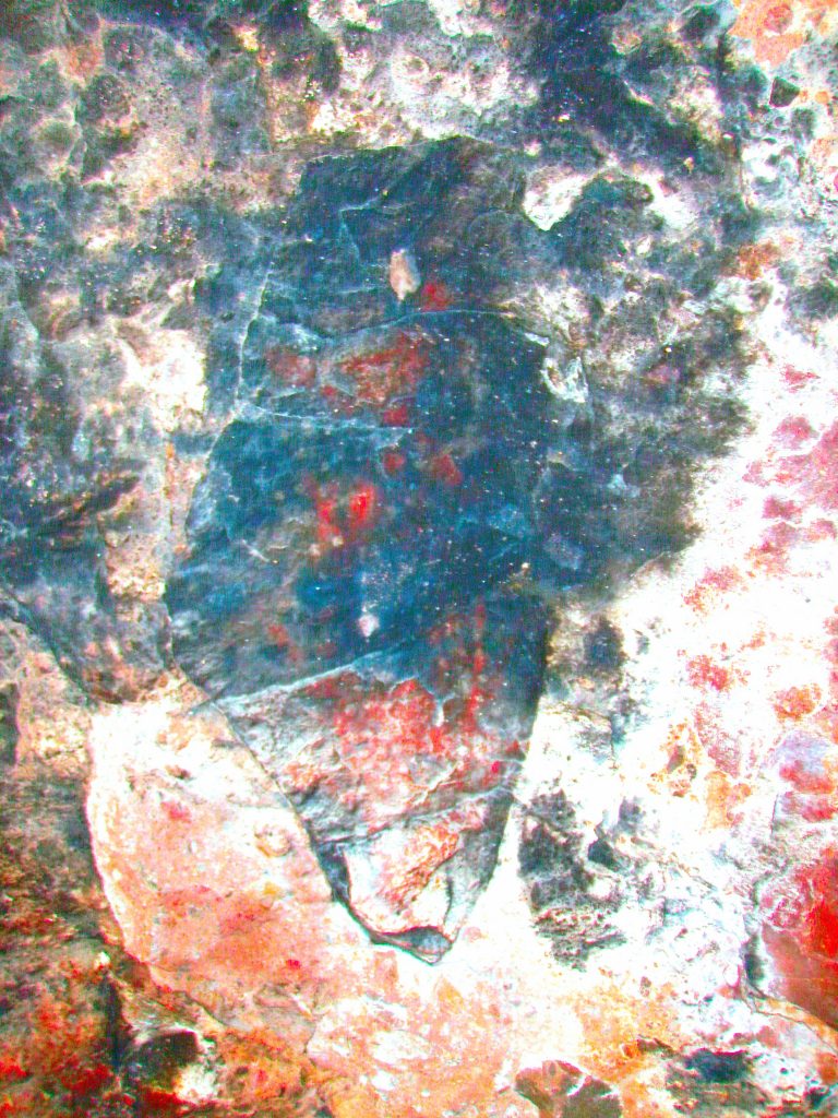
Fig 1 as above enhanced by Dstretch _lab
Also, as the circles are perfectly round and seemed to be exactly the same size throughout the figure, I expect they were made with a tool rather than a finger. To my knowledge there are no other pictographs in the central Baja area depicting a whale shark, or depicting a whale shark with this white circle detail. Another consideration is that the whale shark is shown with the head down. This configuration is usually the exception and like creatures are normally shown with the head up.
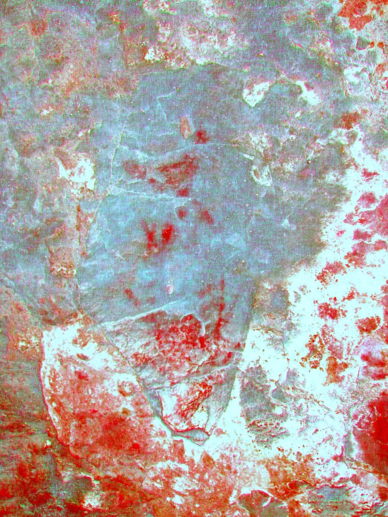
Fig 1 as above enhanced by Dstretch _ywe
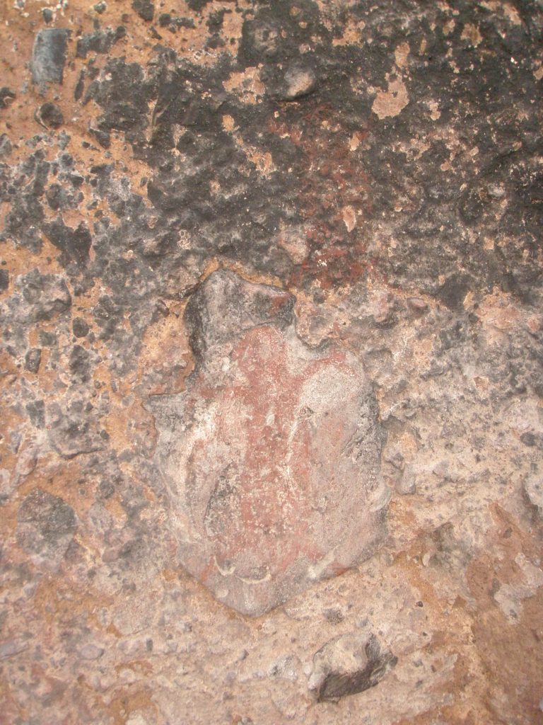
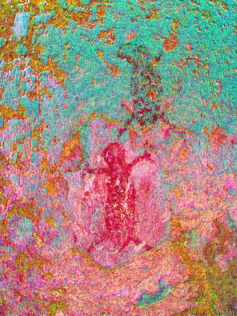
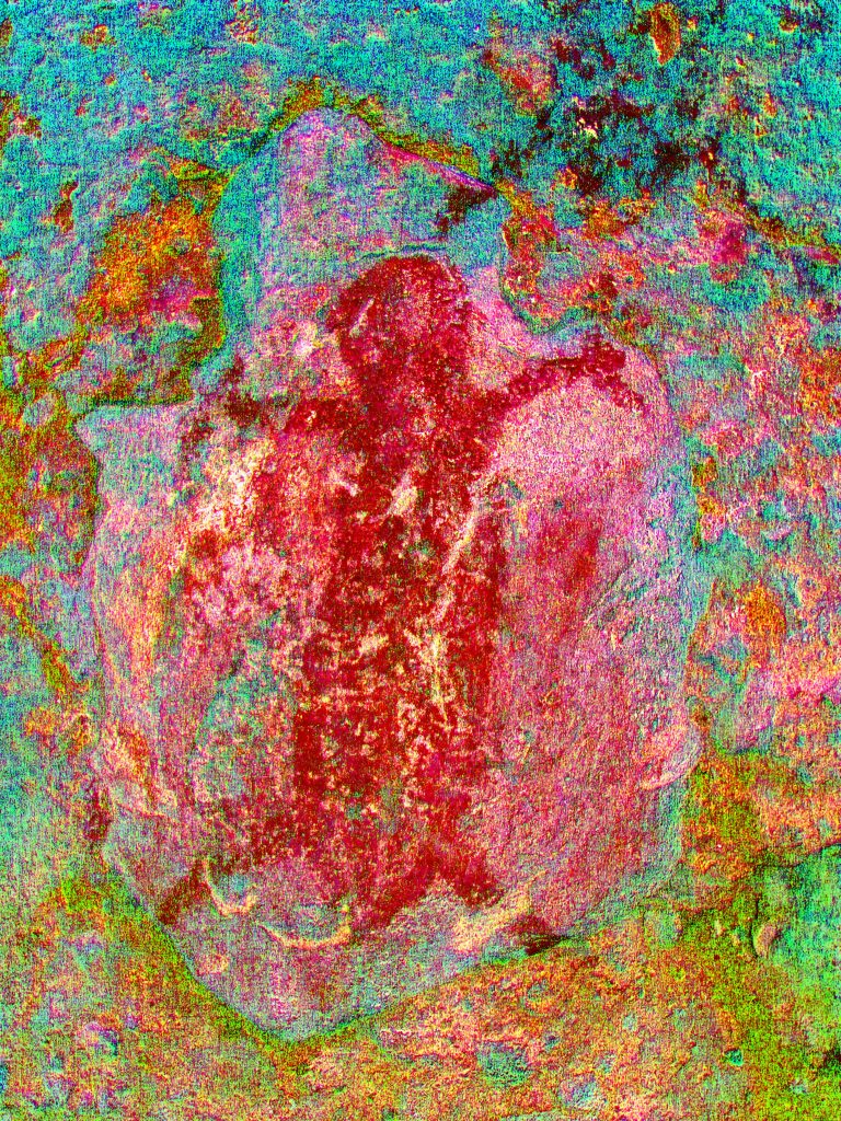
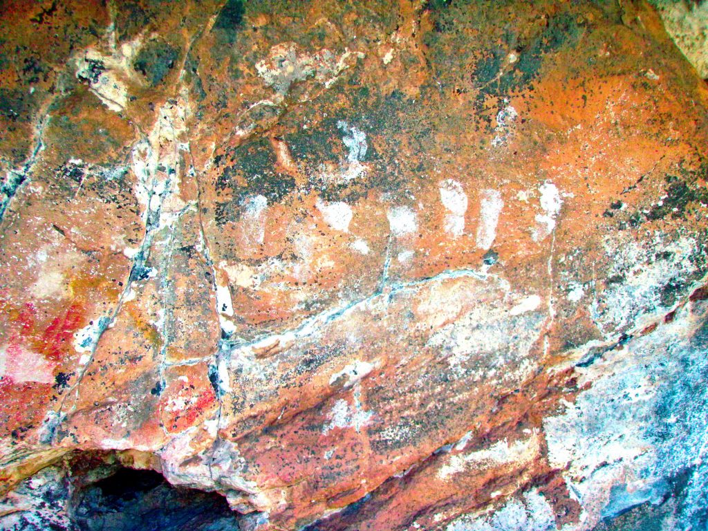
Figure 2. Red women on left side of the shelter about 15cm high totally filled in red, oversize female genitals evident. Above the first figure is another figure with it’s foot almost touching the head of the woman below. This upper figure is on rougher, smoke blackened rock and is faded. Drawings are fairly crude and lacking in detail. It is possible to make out that the hands show three digits.
Dstretch _crgb photo by author
There are many other figures in the shelter that are faded or obscured and lacking in detail. Enhancing the photographs taken of them produced no additional detail unfortunately.
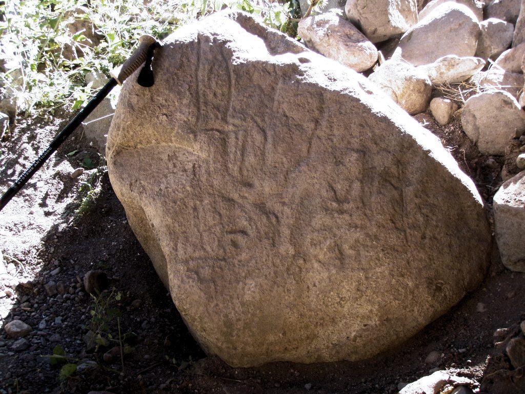
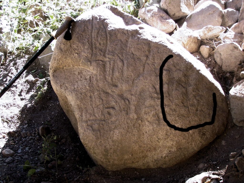
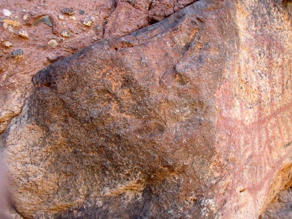
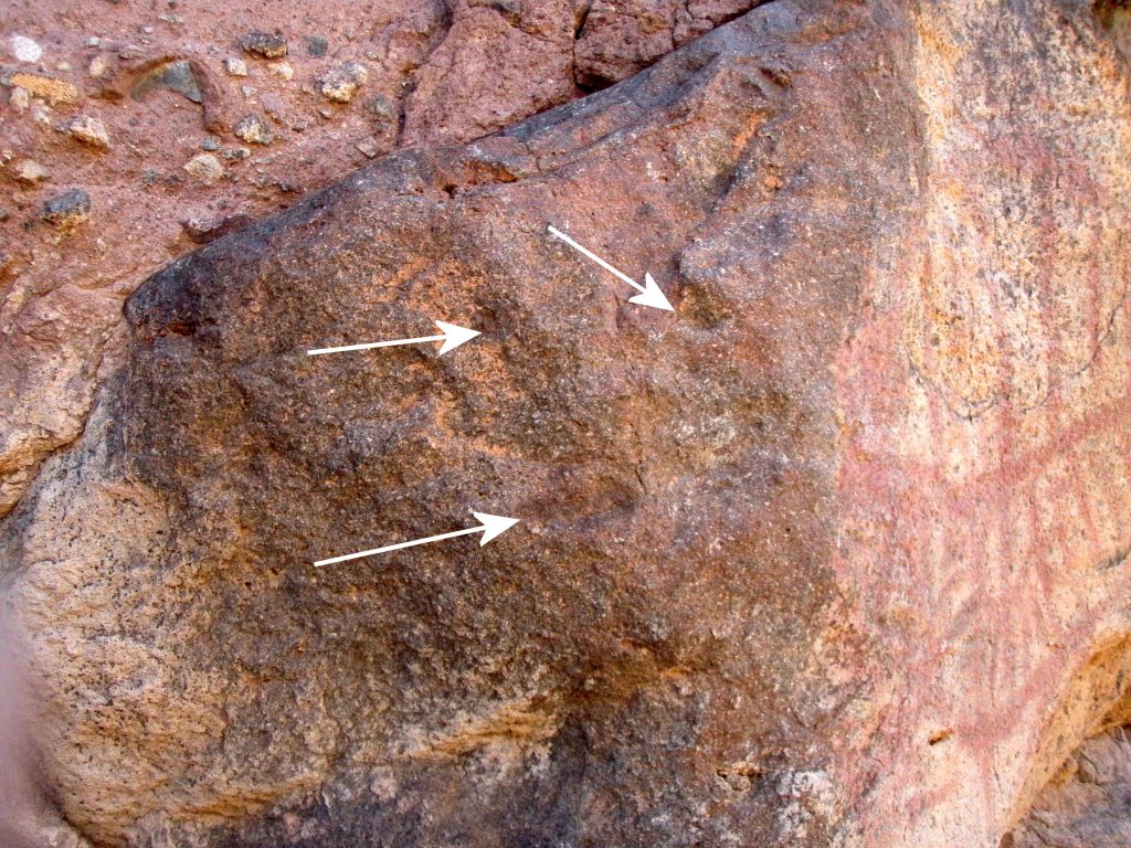
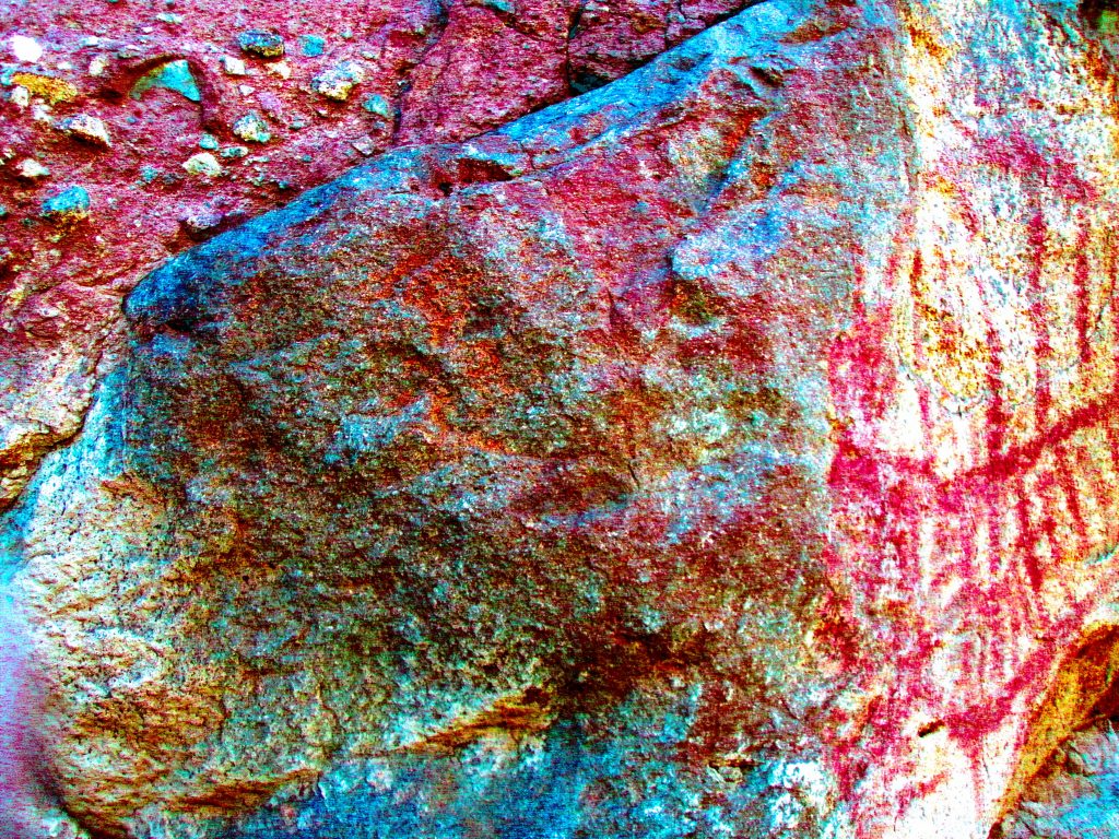
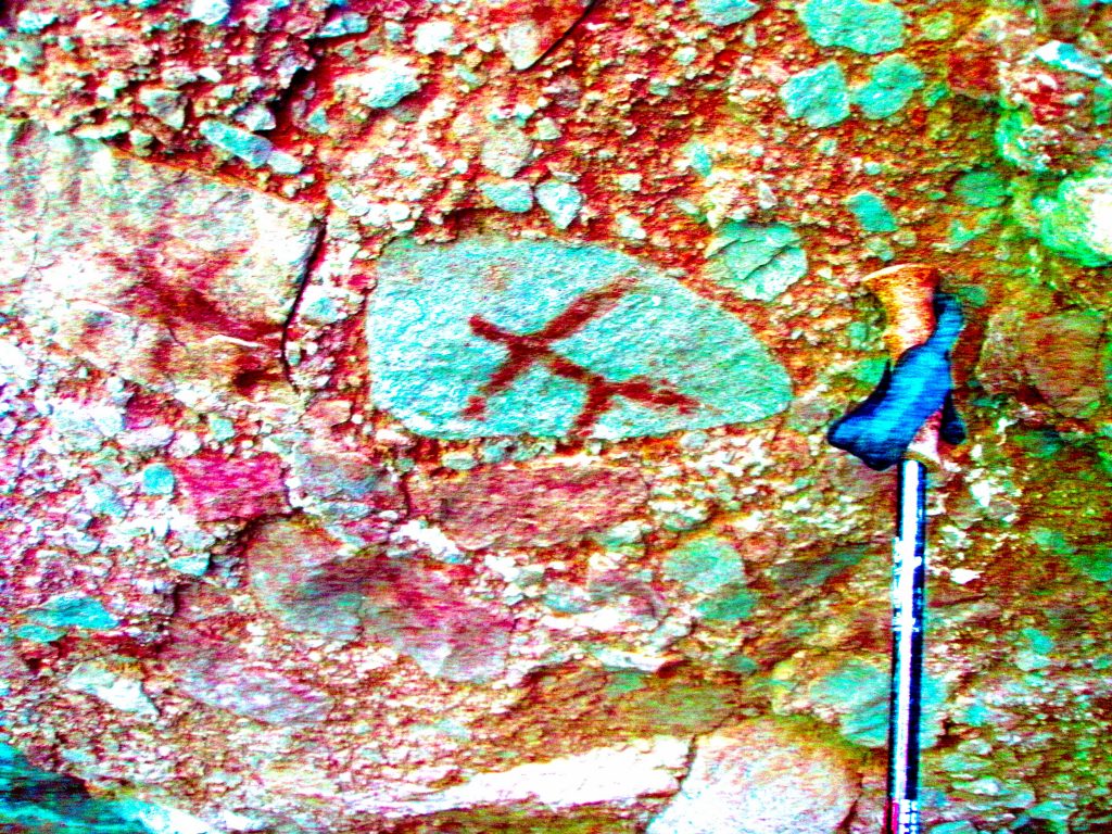
On the left side of the shelter at ground level there was a rock of granite type material that appeared to have some petroglyph markings on it. After removing some of the surrounding rocks and debris, a depiction of what could be a Shaman’s Mask appeared. The worked surface faces north and is slightly angled out at the bottom. The mask is about 50cms high and 30cm wide and seems to have two large circular “eyes” at the bottom with patterns inside and about. Above are vertical grooves/ lines with slight waves or/and angled turns in them. In the nearby Piedras Pintados site there are two petoglyphs with similar markings.
photo by author with contrast enhanced
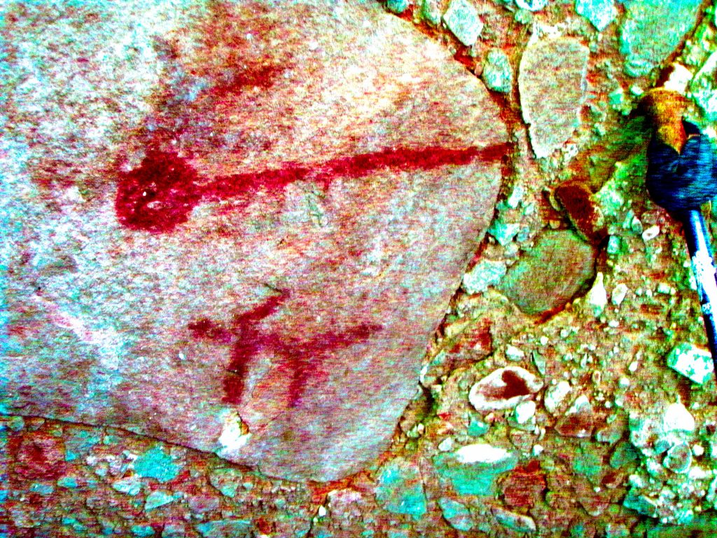
On the right side of the panel there is what appears to be a lizard about 12cms long with the head up.
On the top surface of the rock there are three inscribed parallel lines about 10cms long. This rock contains the only petroglyphs found in this part of the arroyo.
It could be construed that the rock and the Shaman’s Mask is positioned so that it would “see” or possibly “guard” all the art in the shelter and anyone using the shelter (edit).
Photo by author with enhanced contrast
Note: This location is about 11.7kms as the crow flies from the Piedras Pintados site west of Mulege.
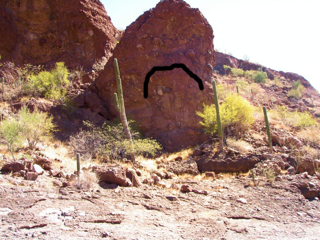
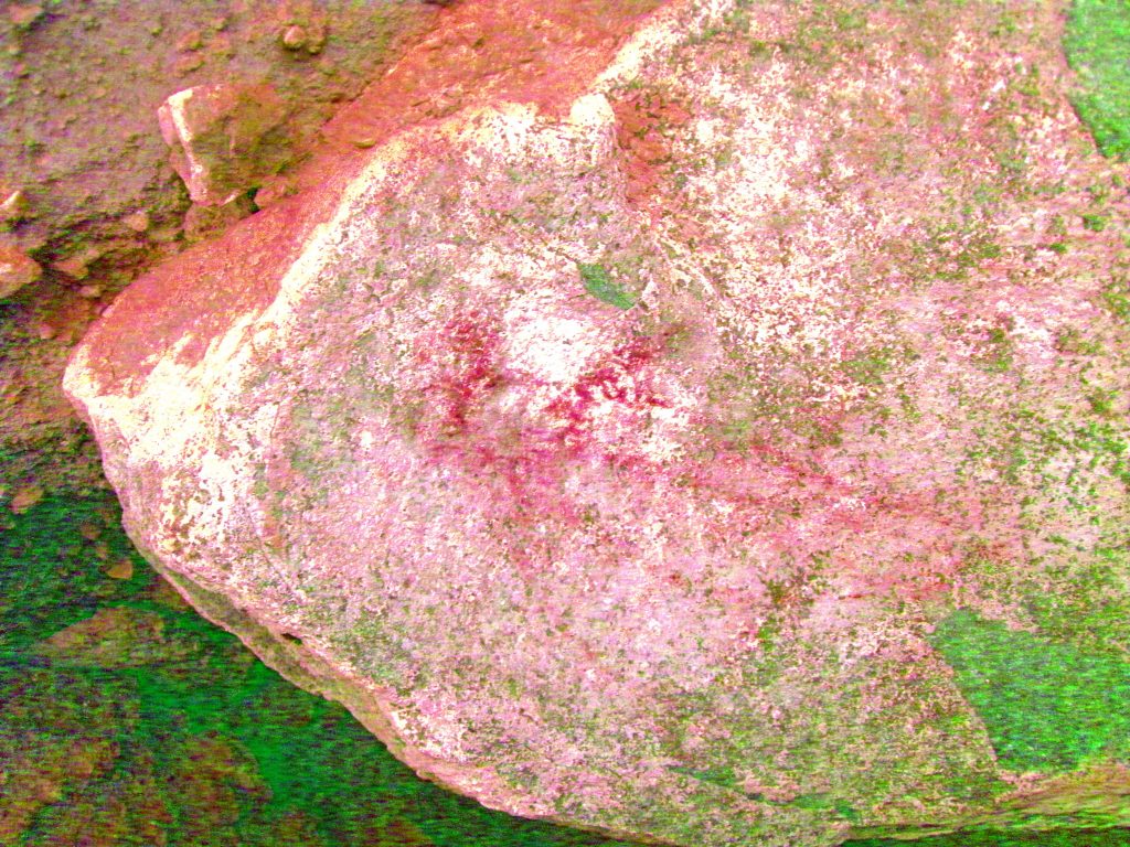
On the opposite side of the pool from the SB 4R C1 shelter with the Shamans Mask there is a short falda of water worn Calish, some loose rocks, boulders and cactus, then a very large monolithic boulder (20 meters high?) With an almost vertical cliff face that faces west across the pool. (Underneath the black sketched frown) there is very noticeable staining from rainwater down this face that from a distance resembles drawings of the legs of three elongated human figures standing beside each other.
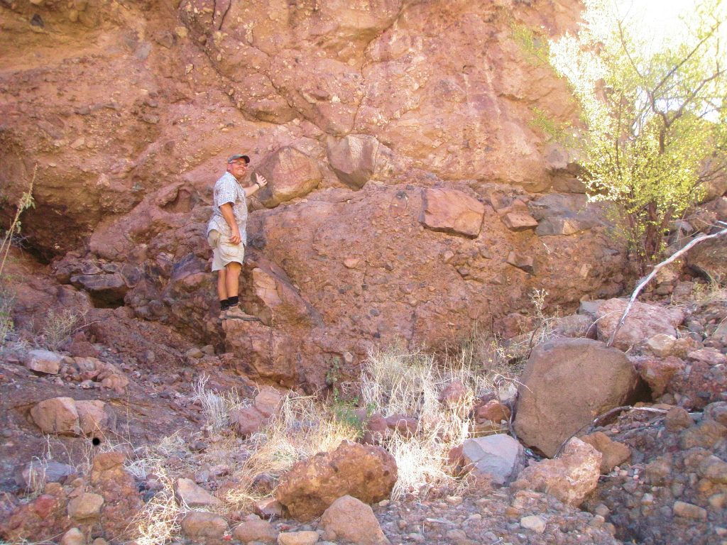
Below and slightly to the left of these “figures” is a prominent boulder with a round flat face incorporated into the cliff about 7 meters above the pool but easily accessible from the ground at the base of the cliff. On this boulder is a painting of what could be a fat deer, or Venado Gordo showing ribs and spine with the head facing the left.
Photo by author shows Bruce Schweers (The guy with the better camera!)
In the lower left of the element there is a circular rendition of possibly the heart in the correct anatomical position. The unique feature of this part is that the artist drew a series of radial lines around the “heart” in what I believe could be an attempt to depict motion, or spiritual essence.(edit) The figure is red outlined and clear, about 30cm long and 20cm high and the head of the animal extended to the left around the edge of the boulder on to rougher material. The legs of the animal are foreshortened, but visible on the bottom of the drawing. The rear legs are angled forward where they would be positioned if, in reality, the deer was about to make a leap.
On a second visit to the site more photos were taken of the rough portion of the boulder to the left of the main part of the image. On enhancing the photos it could be seen (with a little imagination) that the artist took advantage of three markings on the surface. . .maybe making them slightly darker and incorporating them into the figure of a deer’s head with two eyes and a mouth or nose, and maybe ears too, in realistic proportion. Cracks in the rock above could help form the shape of the deer’s antlers. Amazingly the head is seen from this angle as a frontal view which would be correct from the viewers perspective when viewing the pictograph of the whole animal. Also, I know of no pictographs of deer where the animal is pictured from the front; always in profile
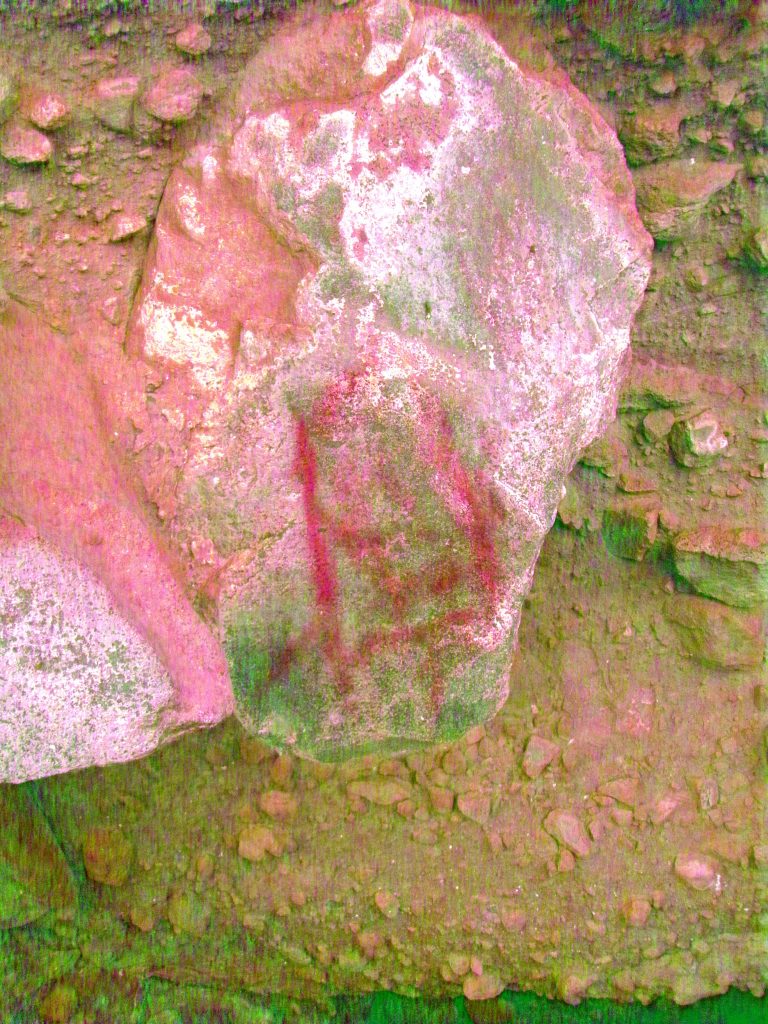
About 1 meter to the right of Venado Gordo is another incorporated boulder about 50cms square with indistinct red markings on it that failed to clarify into a recognizable object when the photo was enhanced. This photo was taken with a very basic camera. Better luck next time!
Below Venado Gordo is a small, flat, vertical surface that contains two distinct holes or cupules about 12mm in diameter that do not appear to be natural. Perhaps made with a stick or pointed tool.
From this vantage point above the pool then, a person standing here would clearly see the area on each side of the pool about 10 – 12 meters distant. On the ground in this area I found a piece of black Obsidian shard, the first I have found in the Conception Bay area.
Immediately to the west side of the shelter there is a jumble of house sized rocks that make up a warren of passages. Some are easily passable, some not. Some have additional art in them. . . Have fun finding them!
Shelter SB 4R C1A
On the second visit to the area one such shelter was found and is SB 4R C1A about 50 meters west of the pool. This shelter extends inwards about 15 meters and is quite dark and makes a few twists and turns.
The shelter has a flat almost vertical face close to the entrance with a geometric pictograph outlined in red made up mostly of vertical lines. This element has effectively been destroyed by a modern graffiti artist who inscribed the initials “CT” over the painted surface. However, on enhancing the photo it can be seen that it was designed as a simple “maze diagram” A foretaste of what was inside the shelter maybe!
Inside are more pictographs in red. One element could be a representation of an Atlatl. Others are stick men.
There is more art hidden in this warren if you care to spend the time to look for it.
About 150 meters southwest of the pool are three large house sized boulders that revealed no art. However, about 15 meters north of this collection of boulders against the canyon side was another cave yielding art. Cave SB 4R C5.
Cave SB 4R C5 at 26.71xxx, 111.94xxx and about 218 (seems high) meters elevation. This is a large standard cave about 30 meters wide, 7 meters high and about 8 meters deep but the height drops down to about 1 meter high and extends back about 10meters or maybe more with a loose dirt floor. There was one possible metate stone in the front of the cave and a scattering of shells. The roof of the cave was blackened with soot. There was a Yani area that was damp when viewed in early February.
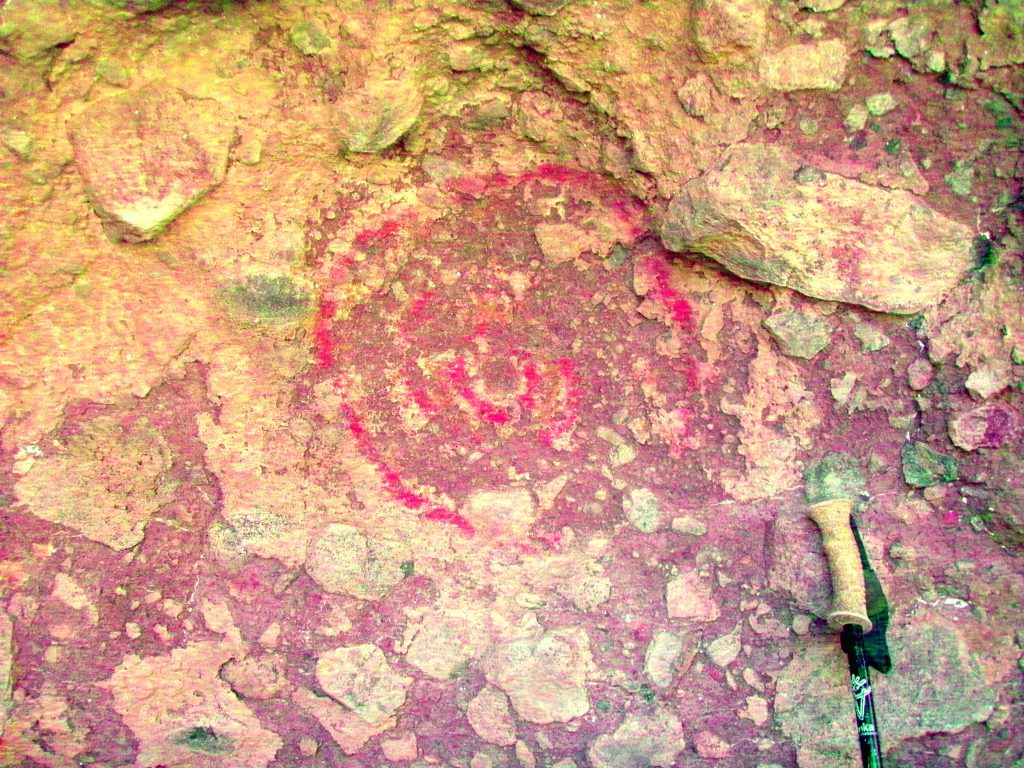
Below the Yani was a reddish black rendition of a 9 pointed star about 20cms in diameter. This was superimposed over another, faded star like element, also in red. To the right there is what could be 6 white impressions of the heel of a hand, positioned vertically and laid out in a row.
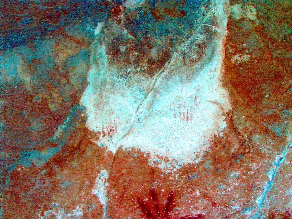
In the immediate area below the Yani seep in the white eflorescent area you can make out another two elements in red. These might be vertical parts of the wings of birds?
About 80 meters upstream from the Venado Gordo pool on the left side of the arroyo against the side of the rock face and about 30 meters off the arroyo is Cave, SB 4R C2.
Compound Cave SB 4R C2 at 26.71xxx, 111.94xxx and 159 meters elevation is about 15 meters wide, 3 meters high and about 4-5 meters deep with two separate “rooms” separated by a low hanging cluster of rock about ½ meter from the ground. The figure on the left is ‘incorporated’ on 3 separate surfaces.
In this cave on the right side, is a prominent series of red concentric circles about 20cm in diameter in fairly good condition considering the loose surface.
There is also fish and other obscure figures. Spotted cow on right? There are shells, rock shards and one Metate stone.
Proceeding on up the arroyo.
Draw on right at 26.71429, 111.94839 altitude 159 meters
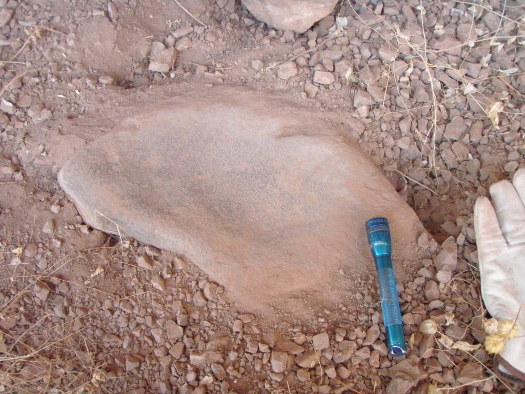
Cave SB 4R C3 in this draw, on the left of the draw facing south at 26.71495, 111.94749 and 170 meters altitude and above a slight sloping bajada with many trees and cactus. This is more of a shelter than a cave as it is very shallow. About 8 meters wide, 1-2 meters deep and partially open above. This contained 1 metate, no shells evident.
Proceeding up the main arroyo.
Large cave on the right facing west.
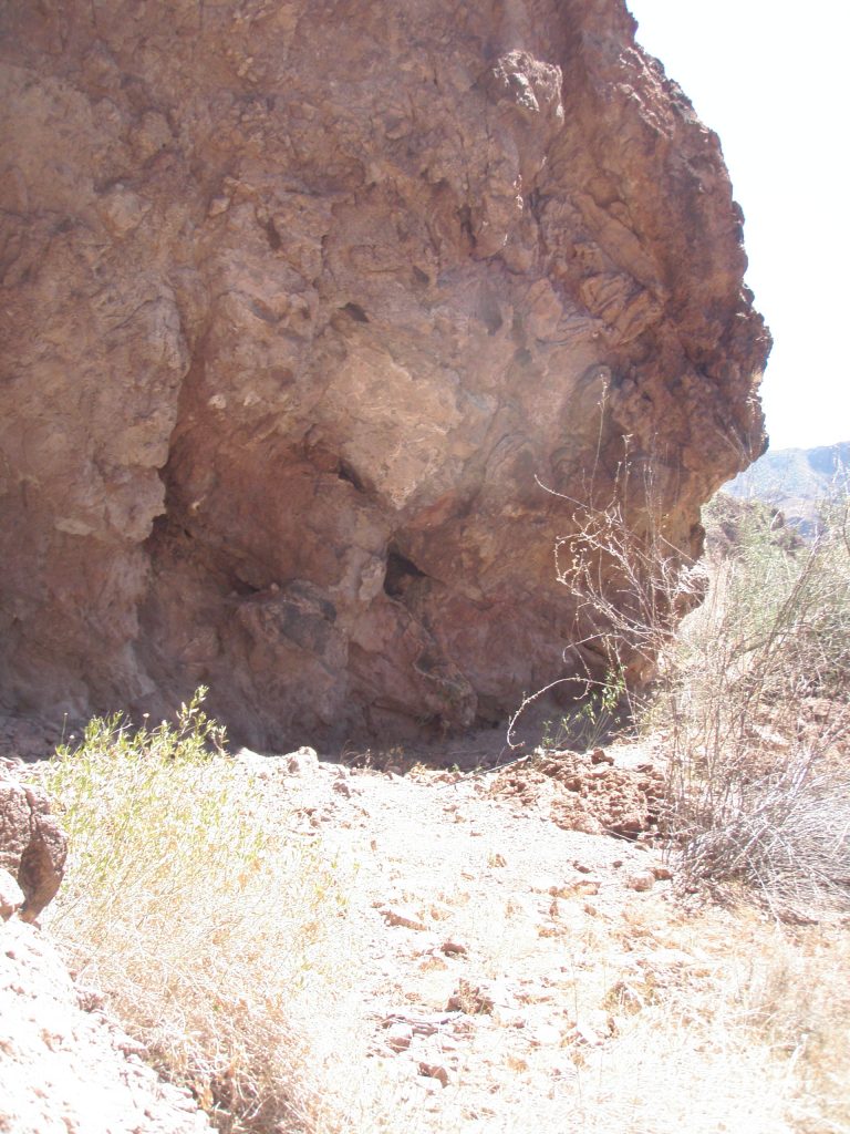
Cave SB 4R C4 at 26.71445, 111.95107 altitude 244 meters (seems high?). This cave is a compound cave about 20 meters wide, 25 meters high and 10 meters deep with a smaller cave/chamber about 4 meters wide , 5 meters high and about 10 meters deep leading off it. There appeared to be loose rocks piled to form a wall at the entrance to this chamber.
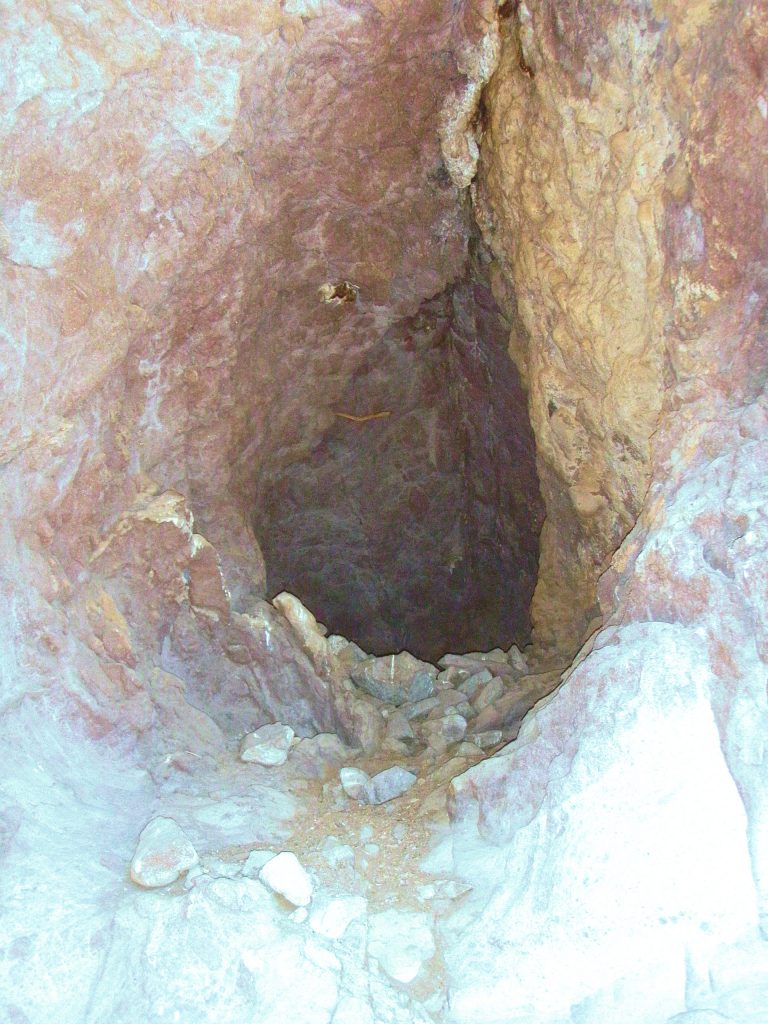
This smaller cave/chamber’s entrance was about 3 meters higher than the floor of the main cave and was not explored as the access was slippery with loose rubble and I felt it was dangerous to attempt this alone. The cave is on the right side of the arroyo and faces west. Nothing was found in the main part of the cave but the smaller cave may yield something.
Do you notice the piled stones at the mouth of the cave and the short piece of wood jammed into a crevice near the roof of the small cave mid way back? Only a human would do that. Hmm!
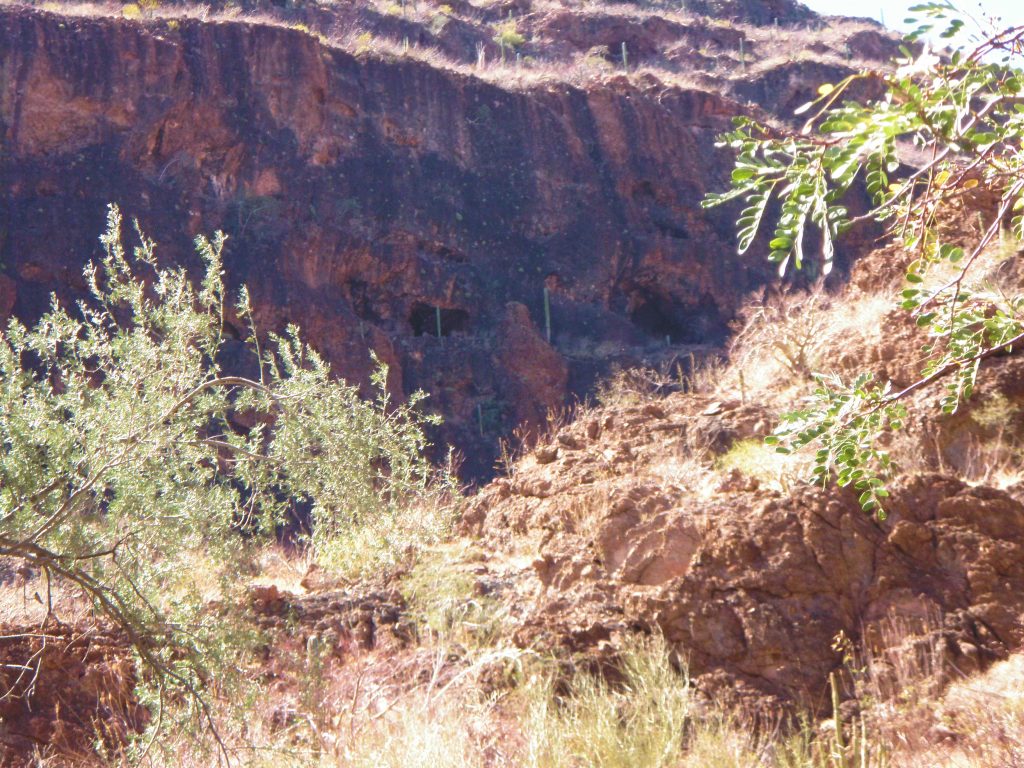
Large overhang containing at least two fairly large size caves with what seems to be significant depth visible on left at 1.7kms and 26.715290, 111.951588 some 170 meters off the arroyo and almost 100 meters above arroyo. Smaller shelters to the left of this. Further uphill to the right is a massive overhang, north facing about 200meters off the arroyo and at 26.715282, 111.952594. Trails or washes are evident below these overhangs.
A visit to these caves would need at least two more hours of your available time. But I believe that because of the Cochimi activity in this specific location, time spent doing this would be a good investment.
This SB 4RIGHT arroyo continues on another Page