Piedras Pintados (Also called Piedras Pintas)
Introduction
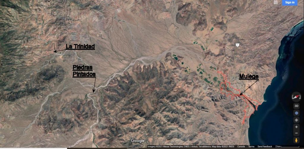
The Piedras Pintados site is a Petroglyph site and is located about 15km west of Mulege, Baja California Sur, in the southern portion of the Mulege drainage basin on the Corral Blanco arroyo. It is accessed by rough, changeable arroyo roads suitable for most vehicles with good ground clearance.
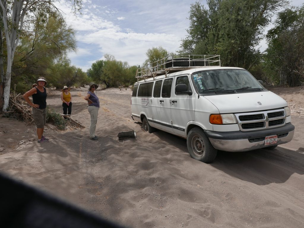
A 2018 guided trip found a short section of trail with very soft sand where 4×4 may be required. Allow about one hour travel time from Mulege.
Everybody now . . . PUSH!
This site is on private land and access is best made with a guide from Mulege. Try Salvador from Mulege Taxi. Salvador is a certified INAH Guide and can combine a trip into the pictograph site at La Trinidad as well. Salvador will normally only show you the main west side of the Piedras Pintados site due to time constraints.
This site is very well written up in an article by Bud Hampton in Rock Art Papers #11, 1994 where he calls the site “A Trinary Petroglyph site of Major Importance” I could not agree more. In this website I will cover all the sites, however, I’ll cover the Habitations and East Side Sites in more detail as they have not been written up before.
The site contains four distinctively different locations clustered around a hill shaped like the lateral moraine left by a glacier. The sites are within the same general area and will be covered on this website as four different pages. All four of the sites can be viewed on the same day for a fairly full day’s excursion.
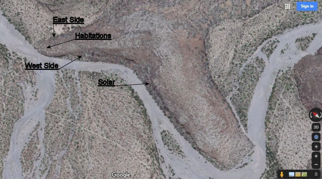
Site 1. West Side Site or Sea Goddess site
Site 2. Solar Site
Site 3. Habitations Site
Site 4. East Side Site.
The Sea Goddess Site, (Site 1)
This part of the site is located on the west side of the hill/moraine, adjacent to the arroyo, starting from where the hill starts to slope up from the level of the arroyo and continues south along the side of the moraine for about 150 meters. Petroglyphs are found from arroyo level to the height of the cliff faces. This part of the site is best viewed in the afternoon allowing the sun to better illuminate the petroglyphs.
The Solar Site, (site 2)
This site is located on the same side of the hill, still adjacent to the arroyo, about 480 meters further south from the figure of the Sea Goddess. At this point the trend of the “moraine” turns about 15 degrees more to the west. As you walk south, there is an area of tumble-down rocks that extend from the top of the moraine to the arroyo level. This is the start of the Solar site.
Habitations Site, (Site 3)
This site is on top of the moraine closer to the north end where the height of the moraine is low. There is a historical trail leading up the hill to the south tending to keep to the west edge of the moraine. Within about 50 meters you start to come across the first of about 12 or more areas of ground that had been cleared of rock and made relatively flat. I examined many of these areas. Most of the Habitation areas had no rocks that were not flat or flattish thus producing a surface suitable for casual habitation.
East Side Site (Site 4)
The east side of the moraine on that side closest to the Habitation areas had numerous (15 – 20) petroglyphs close to the upper edge and at distances down towards the bottom of the tumbled rock. Many of the petroglyphs were darkly patinated and I am assuming of great age. Many of the petroglyphs were made on “Bell Rocks” and the artists must have been amused by the sound made when the glyphs were inscribed.
Observations and Conclusions
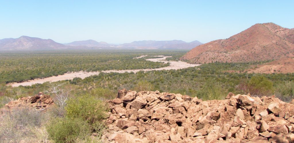
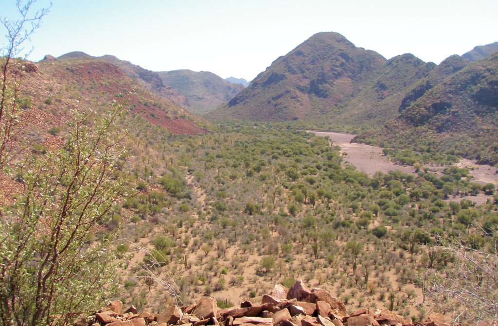
The view from the top of the moraine is superb with clear vistas many kilometers to the north, west and south across the drainage basin.
View to the North
This would truly be a magical place at night with a clear canopy of stars as a blanket and this might enhance any perceived spiritual essence of the location.
View to the South
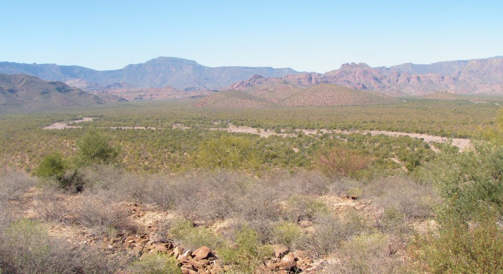
It can be seen that there are three large arroyos that meet at this location, two from the west and the main one from the south, all of them draining a large geographic area of many thousands of hectares.
View to the West and peaks of La Trinidad
From this vantage point of height it is clear that the arroyos would also have provided an easy traveling route for the Cochimi and would have made this site an easy focal point for meetings or gatherings. This fact, and the numerous habitation areas on the top surfaces of the moraine suggest the site to be a regular historical stopping point for traveling Cochimi. (And those who came before them)
Cochimi Travel Routes
On the east side of the Piedras Pintados site and further on to the east about 8km at the head of the Piedra Pinto arroyo, there is a low saddle in the hills at about 380meters elevation connecting to the San Pedro arroyo and Bahia Conception some 12km further on.
Traveling up the main Corral Blanco arroyo to the south, the path of the arroyo curves eastward at the south end of the moraine and meanders through the hills to the south. About 4 kms upstream of the Piedras Pintados site the arroyo again skirts the side of a steep slope and bluff where there are currently numerous pools of open water. (That can also be seen on Google Earth) I suspect that in Cochimi historical times when (most of) the petroglyphs were made, there were similar pools of water located at the Piedras Pintados site (edit). Also, after the importance of the site was established and that portion of the arroyo was filled in with sand and rocks, it would have been a relatively easy task to excavate down from the surface the required distance to reach the water table. This is successfully done by ranchers in present times in many locations.
From the Piedras Pintados site going south, the arroyo fans out to the larger part of the drainage basin. From this location then, a traveling group of Cochimi can cross the divide into the arroyos draining to Bahia Conception; the arroyo El Tordillo for Los Cocos beach, La Enramada for Santa Barbara and El Burro beaches, and the San Juan arroyo for the Buenaventura area. This suggests the Piedras Pintados site is both geographically and historically important and would be on a seasonal traveling route between the Sierra Guadalupe and the rich fishing grounds of Bahia Conception.
There is a rough road from the Piedras Pintados site that will take you further up the main arroyo to the south and on to Corral Blanco, but the way to vehicles is barred by a locked gate abut 2kms on. Access to the pools about 3kms further up past the gate must be by foot via the arroyo unless you can access a key. On visiting these pools and the terrain surrounding them, no petroglyphs or pictographs were found. On a subsequent trip on a motorcycle I was able to drive to a point in the Mulege arroyo that was less than 2km from the top end of the 4 Right Santa Barbara arroyo so indicating a relatively easy route from Piedras Pintados to the beaches of Conception Bay.