Lower Arroyo:
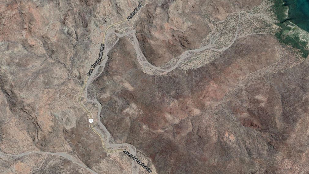
This stretches from the beaches of Santa Barbara bay to the Vado where the arroyo crosses the Mex1 highway. (There is a private road leading through the lower part of the arroyo.) Distances shown are measured from the Vado towards the beach.
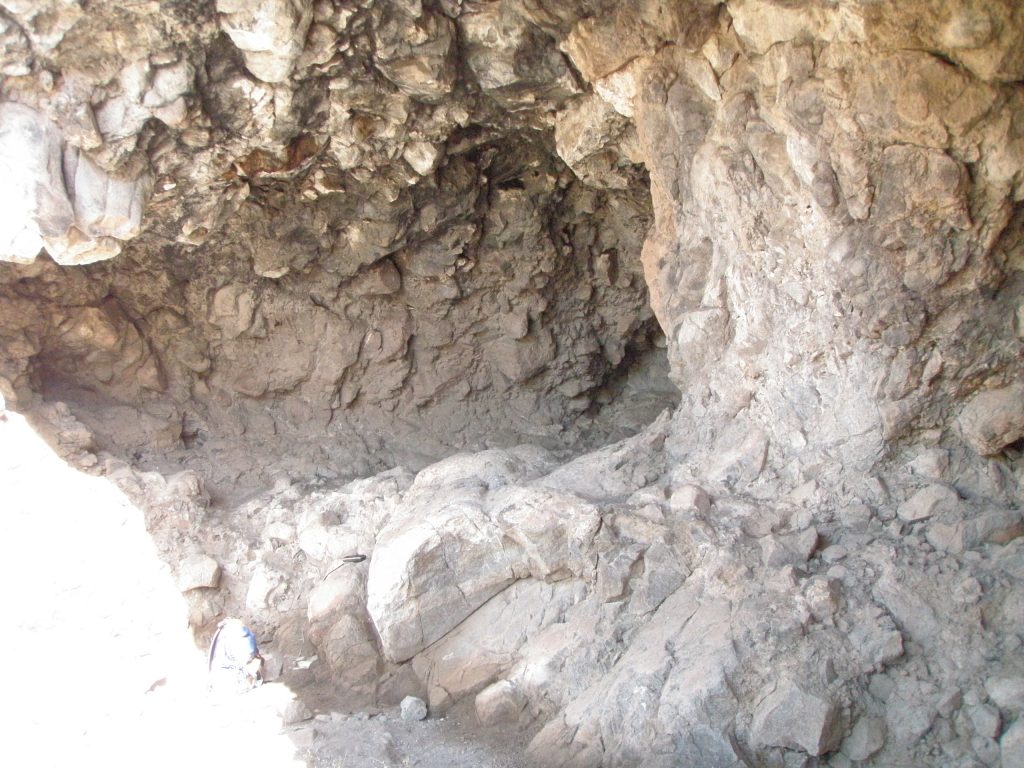
Contains the locally called Coyote Cave at 26.70xxx, 111.90xxx. Altitude 15 meters. Cave is about 15M wide, 5M high, 10M deep. Art is in very poor condition with lots of grease and body oils on the walls from hand rubbing. Has shell midden, no metates. This cave is very easily accessed by casual visitors and no regard for the fragility of the pictographs is evident.
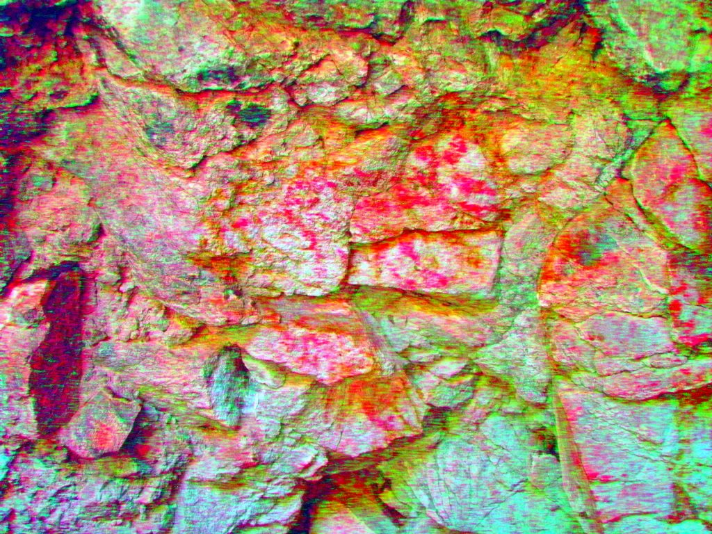
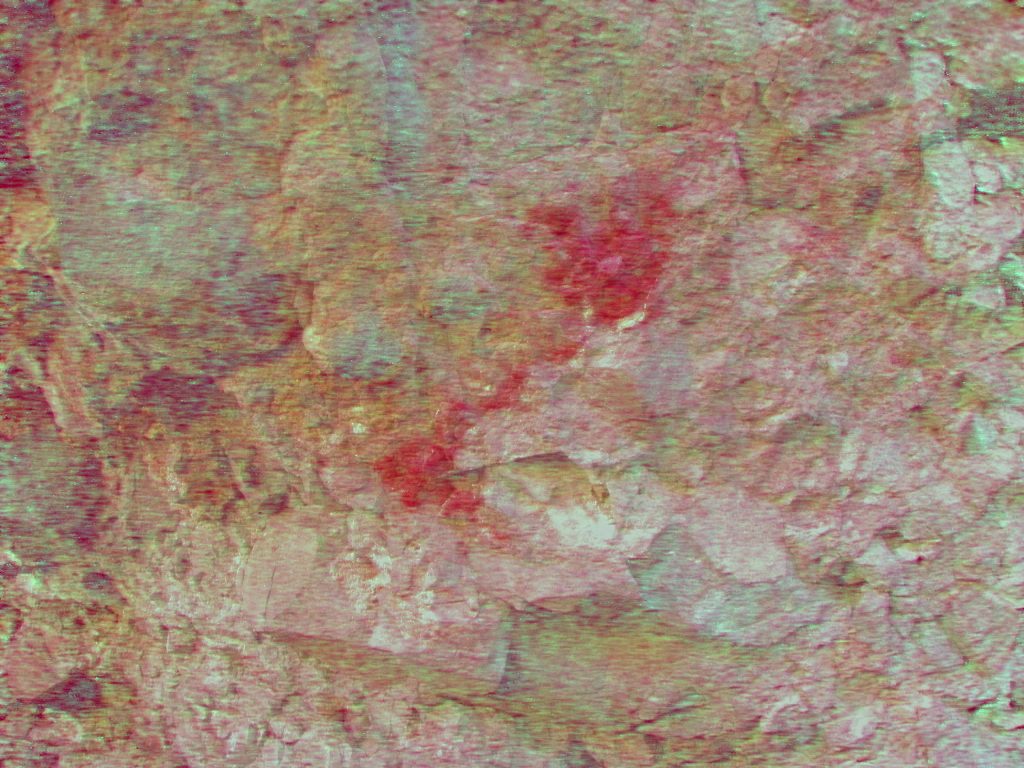
The Coyote (center of photo, facing right) is very faded and almost invisible to the eye without enhancing with DStretch. There are other faded and damaged pictographs.
It is believed that this cave art gave the name to the nearby Coyote Beach.
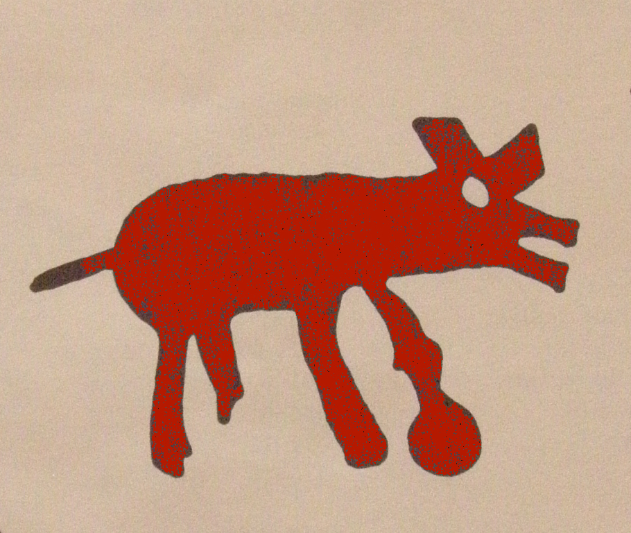
Here is a fairly accurate drawing of the ‘Coyote’ This has similarities to the pictograph found in the Pescadito cave near Los Coco’s beach, only at that location I compare the image to a Rabbit
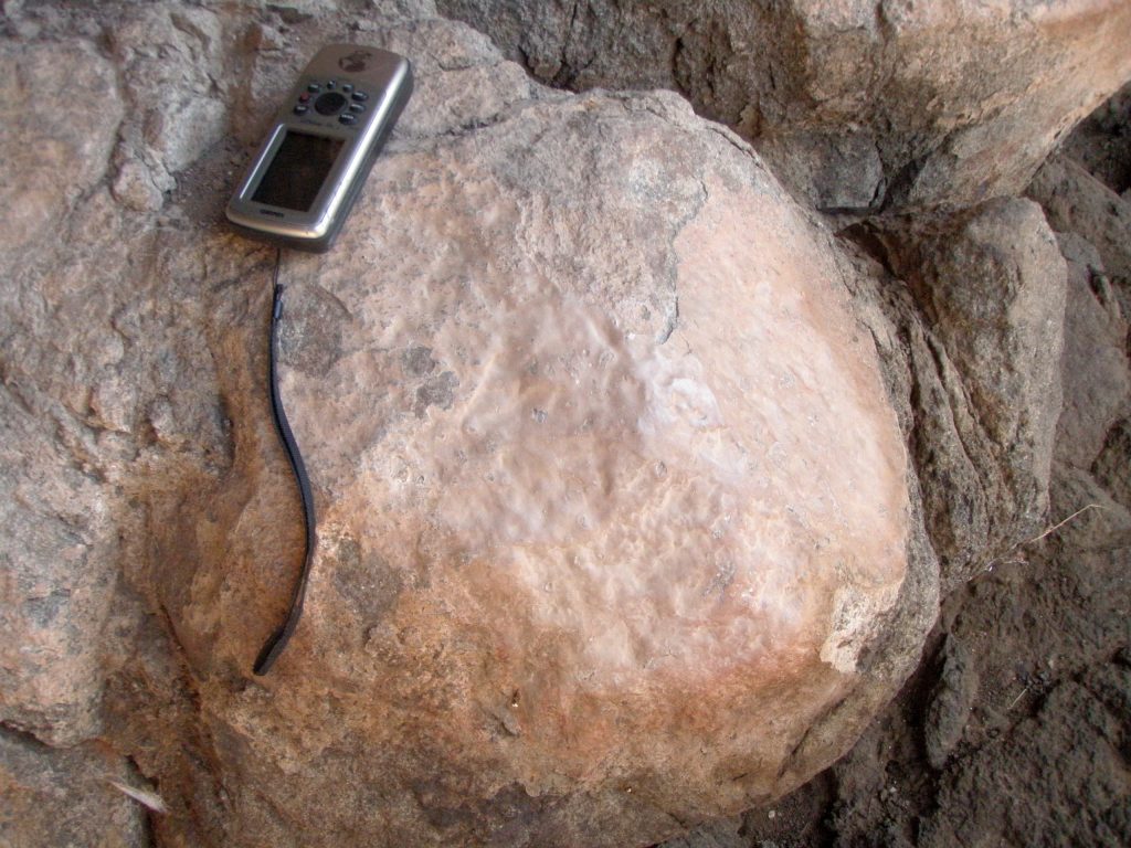
On a prominent boulder close to the mouth of Coyote Cave you can see a light brown, somewhat glossy surface. Parts have flaked off showing a thickness of about 1 millimeter. Many other caves I have visited have similar coated boulders. I call this a ‘Processing Boulder‘ and believe that hides and skins have been scraped here causing this biological/mineral deposit. Yes, No?
I explored the small shelters immediately above and to the right (south) of Coyote Cave, but no evidence of historic use was found.
Rock bluff slightly upstream from the Coyote Cave on south side of arroyo at 26.70783, 111.90816. Altitude 26 meters. Cave SBLC2. This contained one overhang/cave with a northwest prospect that had two areas of faint red paint colouring on wall.. No midden, no metates.
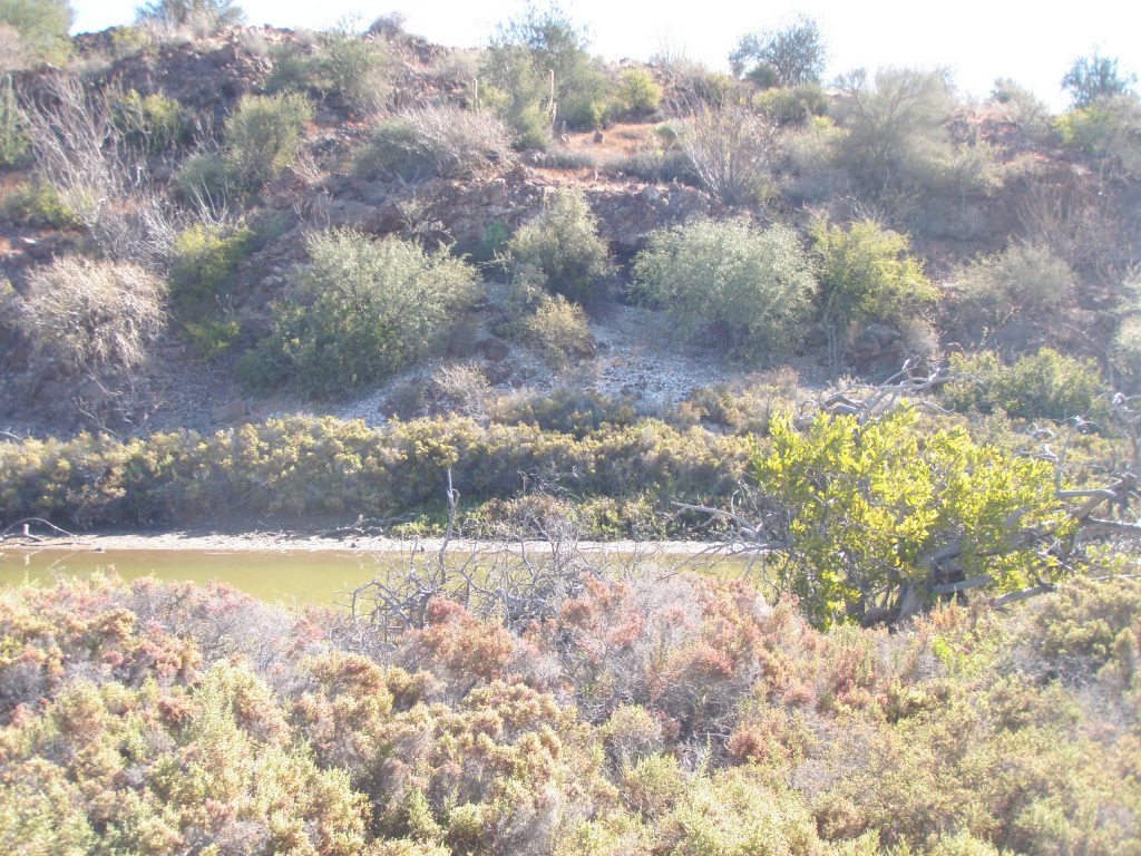
There are south facing overhangs for first 150 meters on left side heading downstream below Coyote cave. Just downstream from three large boulders is a cave.
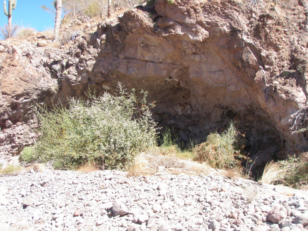
Fish Cave 26.70766, 111.90660 altitude 10 meters but at arroyo level. This cave is about 20 meters wide, 5 meters high and about 3 meters deep. The rock is a soft gray granite-like substance that powders easily. Cave faces west.
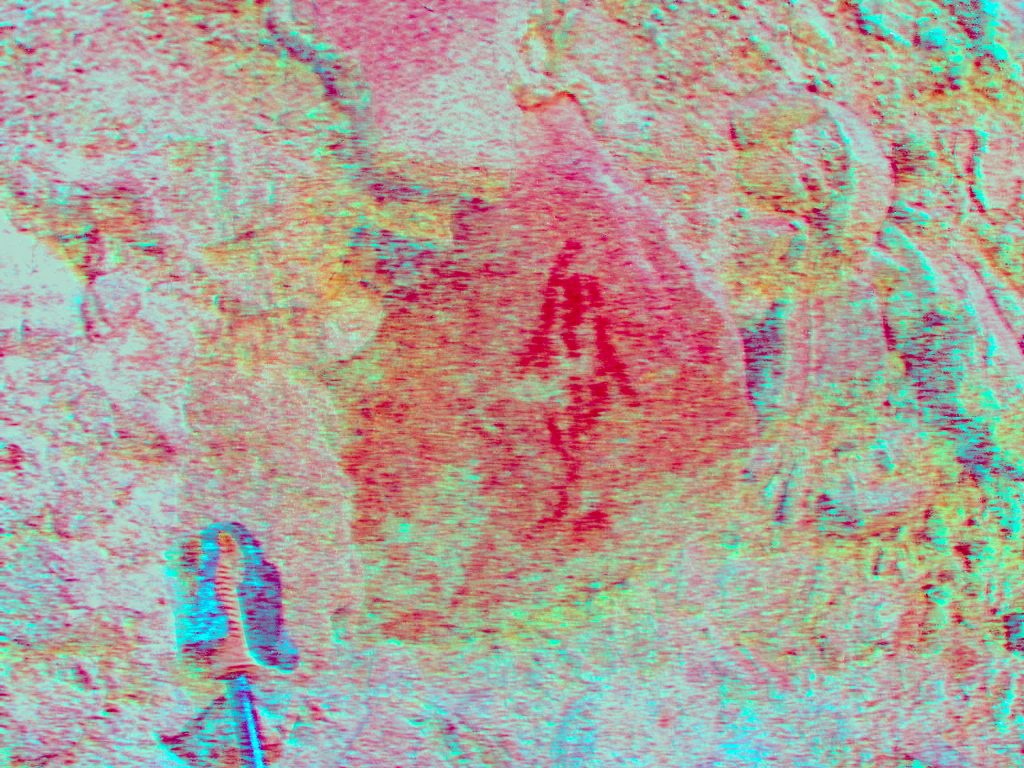
This cave/shelter contains a distinct fish about 20cms long in red paint with head up. There are three other paint sources that when enhanced did not reveal any distinct form. As this shelter is at arroyo level, floods will tend to scour out the rock and further degrade the paintings.
Gary Davidson and Jim Workman also found some petroglyph art but I could not locate any.
Rock bluff on south side at about 0.75km at 26.702422,111.903424 Has overhangs and small rock shelters with no art present.
North facing rocks at about 1.6km at 26.702952, 111.895606 has two shallow caves with no art or metates.
Northwest side of rocky point that sticks out into Santa Barbara Bay at about 3.2km at 26.701018, 111.883811. This prospect was accessed from the water by boat as this was an easier way to get here requiring little walking.
Cave SBLC1. There is a well formed standard cave on this point some 40 meters from the ocean facing northwest. Cave is about 5 meters above sea level and has extensive shell midden in front. There were no metates in cave. No art work in cave.
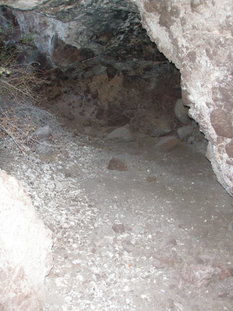
An inside shot of cave SBLC1 showing the abundant shells. Notice the fire blackening on the roof as well.
There were other shelters in this rocky point at the arroyo level but they were scoured out by high tides so no middens were found here.
Visited January 13th 2016.