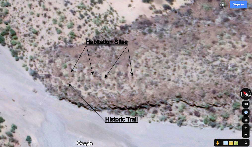
Habitations Site, (Site 3)
The main features of this site are:
The Historical Trail
The Habitation areas
The ‘Cochimi Road’
The Petroglyphs
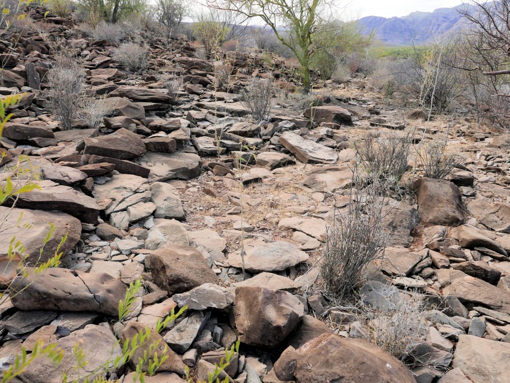
The easiest way to access the top of the hill/Moraine is at the north end. Here the slope of the top surface of the Moraine approaches the level of the arroyo. Within a few meters it was evident that there was a historical trail leading up the hill to the south tending to keep to the west edge of the moraine. (Of sufficient size to be evident on Google Earth)
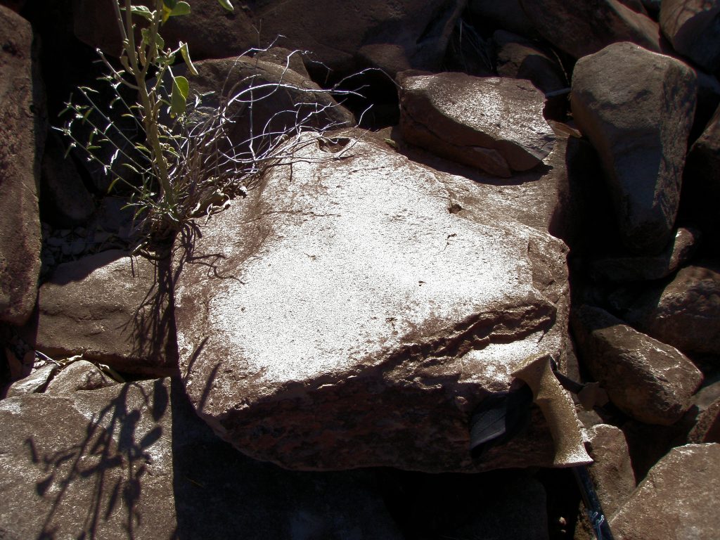
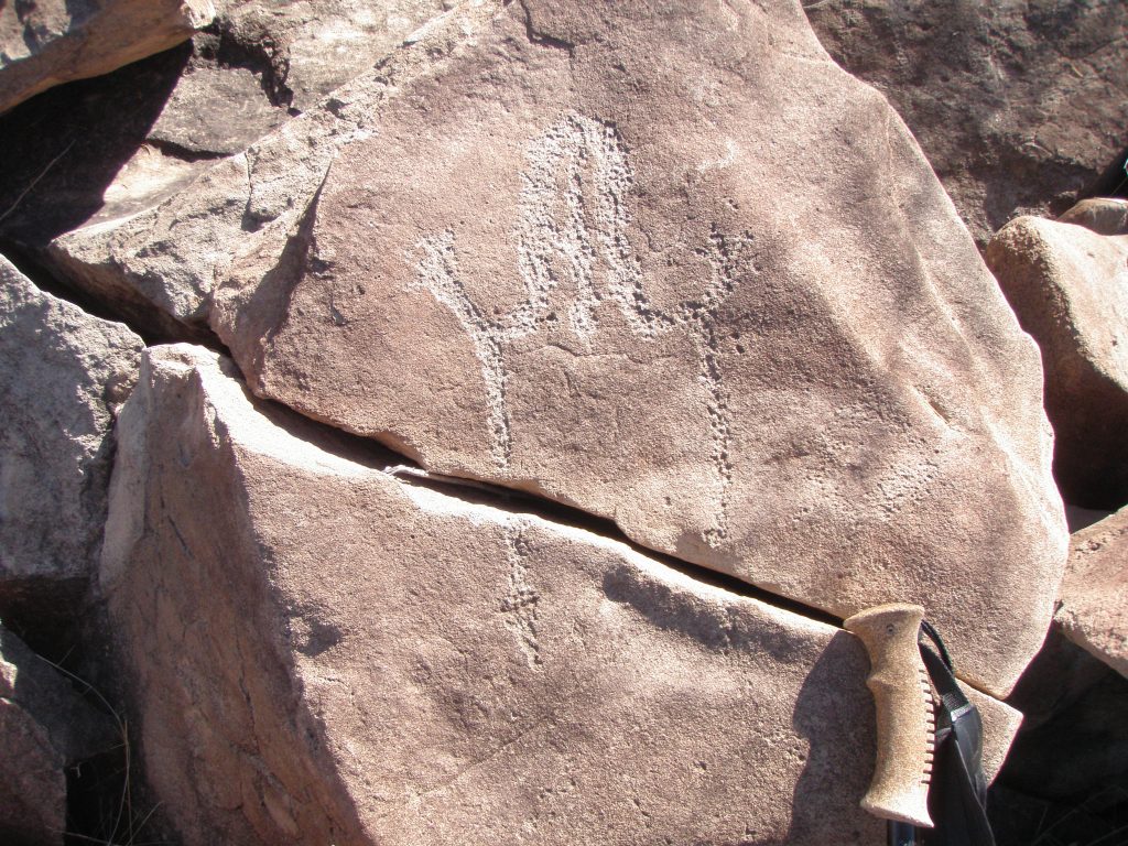
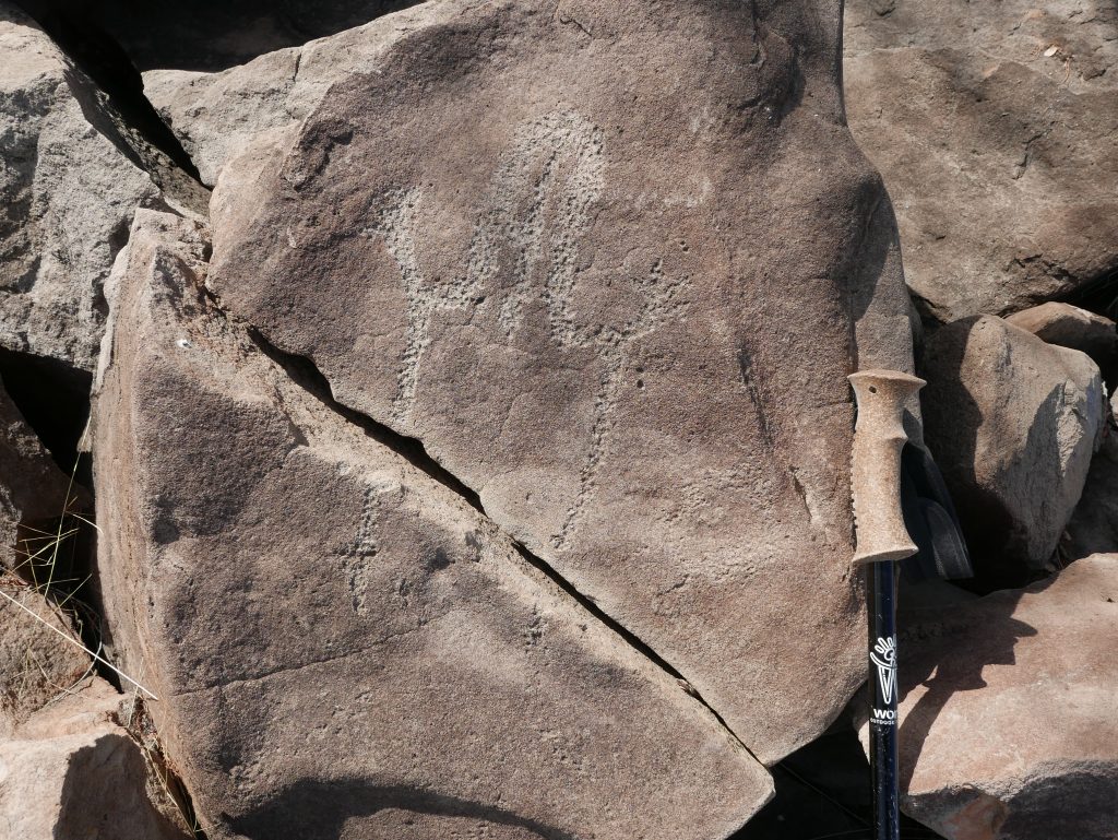
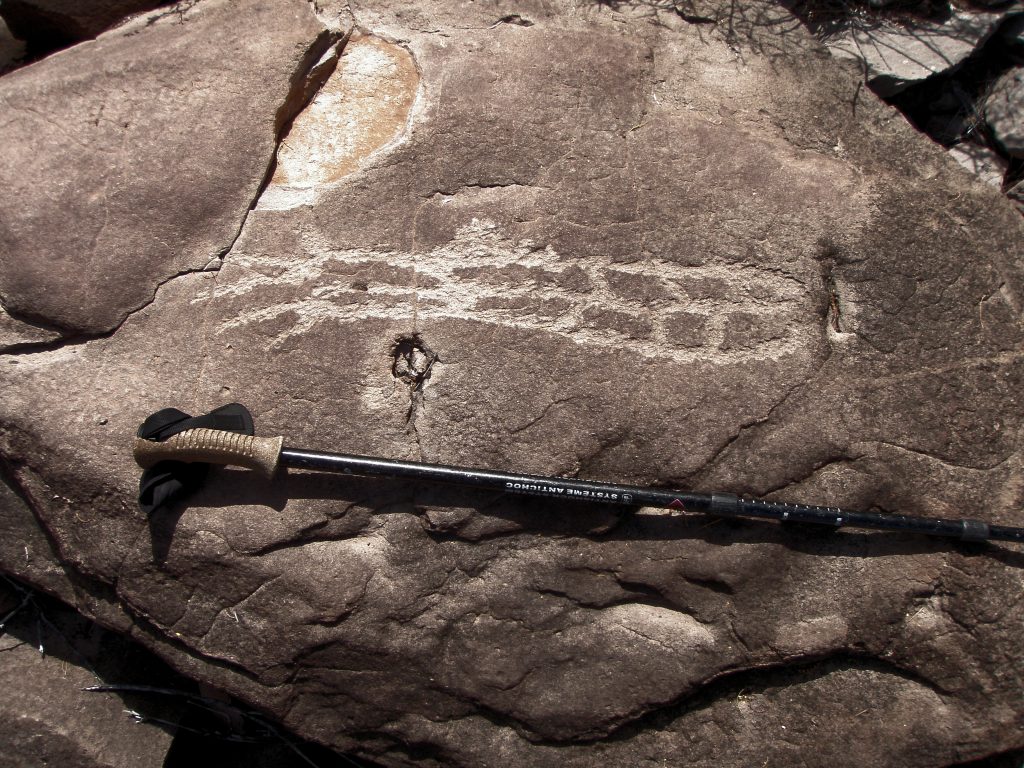
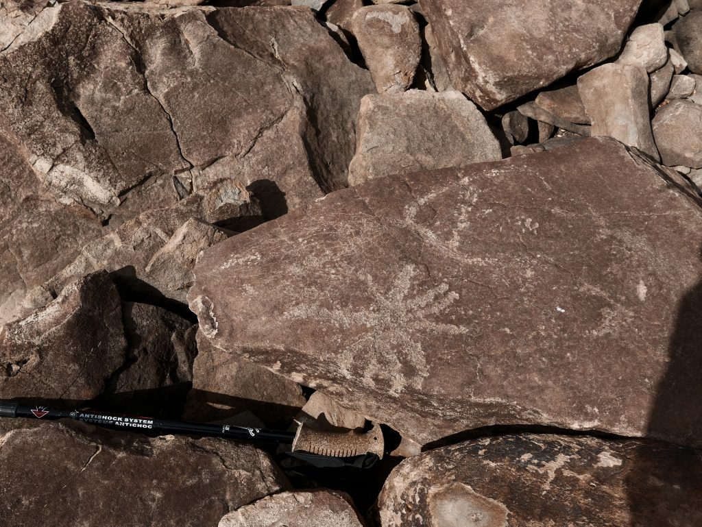
Close to the start of this trail there is a boulder imbedded in the sand with a handful of petroglyph markings on it. (Maybe marking the start of the trail or another Lookout Post? Edit.) The boulder is about one meter by 60 cms.
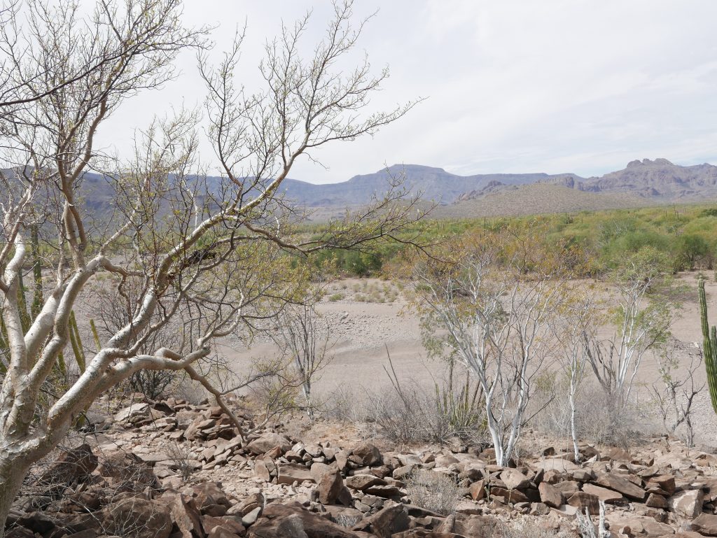
The Historical Trail is best seen in the Google snip at the front of this page. However the lighter coloured rocks marking the trail can be seen in this photo. The triple peaks of La Trinidad about 12kms away.
A discussion on Historical Trails is available in the Section ‘In Search of Manuel Diaz’ Cave’ or the button below.
Photo A49 by author
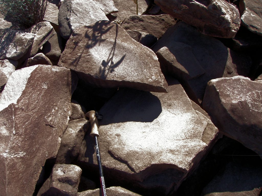
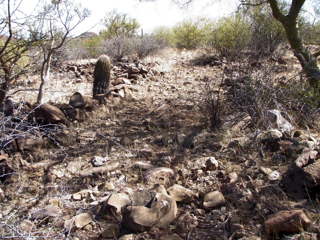
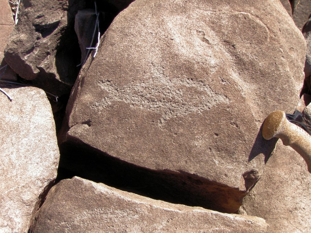
Within about 40 meters from the start of the Historic Trail you start to come across the first of about 12 or more areas of ground that had been cleared of rock and made relatively flat. On one such site, the rocks that would originally have covered the area had been moved to one side and piled on other rocks to make a clearing of maybe 5 meters by 5 meters with a well defined edge. The remaining surface in the clearings had no rocks that were not flat or flattish thus producing a surface suitable for casual habitation. This collection of clearings existed for about the first 200 meters or so up the gradual north slope of the moraine. There was another grouping of clearings closer to the top of the moraine some 500 meters further on to the south.
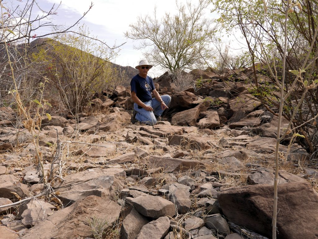
The author at one of the Habitation sites as evidenced by the fairly level state and the surface rocks having no patina. Occasional rains would have washed some of the soil away leaving the rocks more prominent.
Photo A8 by author
Another good shot of a Habitation area. I associate these Habitation areas to the Cochimi.
Photo A 19 by author
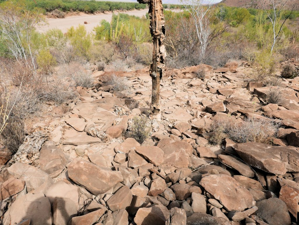
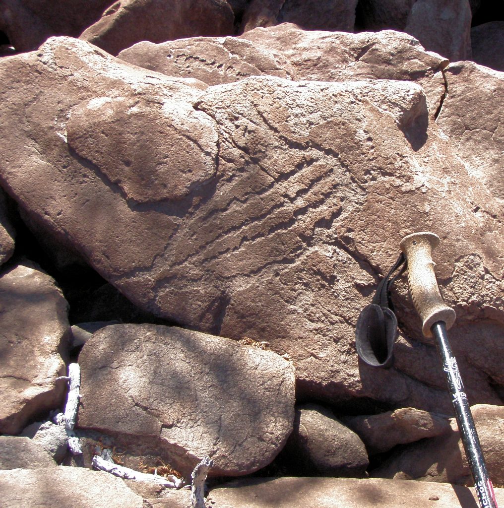
One such site is dominated by the upright (in 2019-20) skeleton of a Cordon Cactus about four meters high, and so is easy to locate if you walk up the historical trail.
Photo A 12 by author.
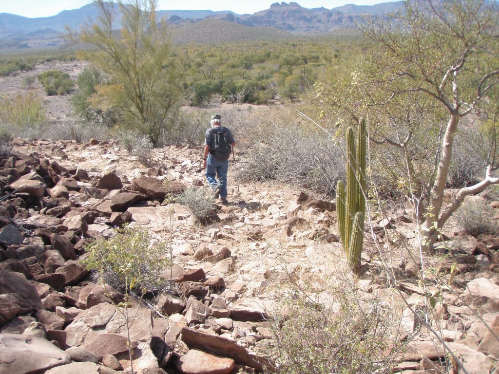
Another Habitation site in the foreground here with the cactus towards the rear of the clearing. My companion is just about to enter into the Historic trail portion.
Photo A 13 by author
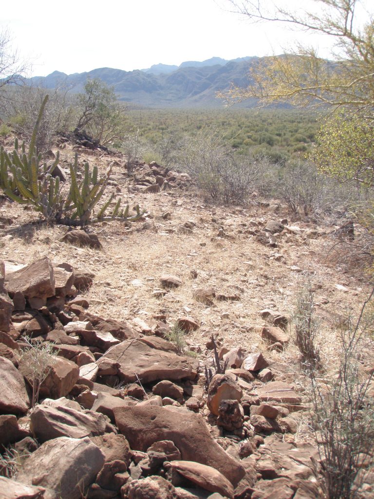
Here is another Habitation area with the Historic trail in the background.
Photo A 15 by author.
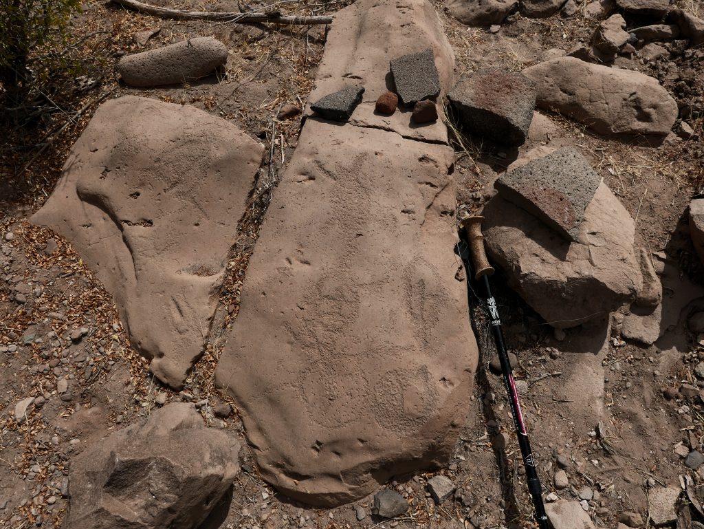
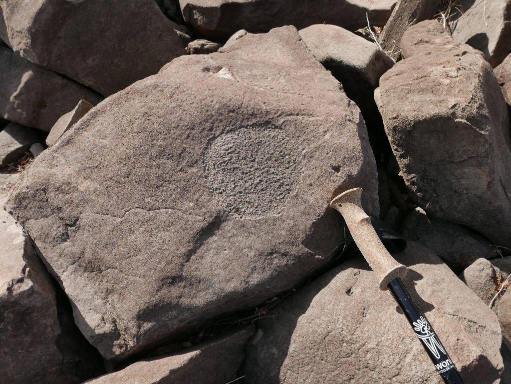
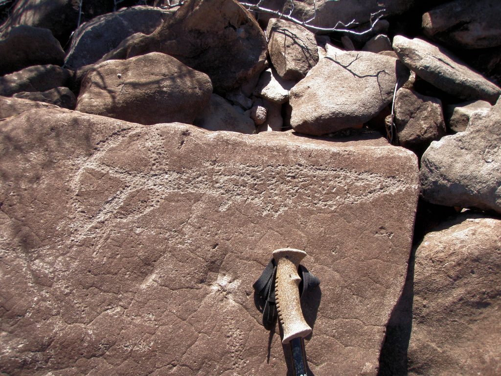
One Habitation clearing, first spotted by Gary Davidson, at about 26.77115N, 112.06424W contained eleven metates formed in the boulders around the edge of the clearing. It is curious that these were found only at one Habitation clearing and not noticed individually in various clearings. This suggests that the act of grinding the seeds was a communal or social event shared by many people.
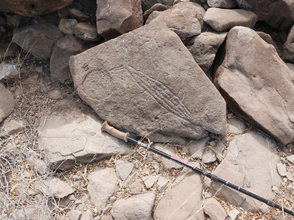
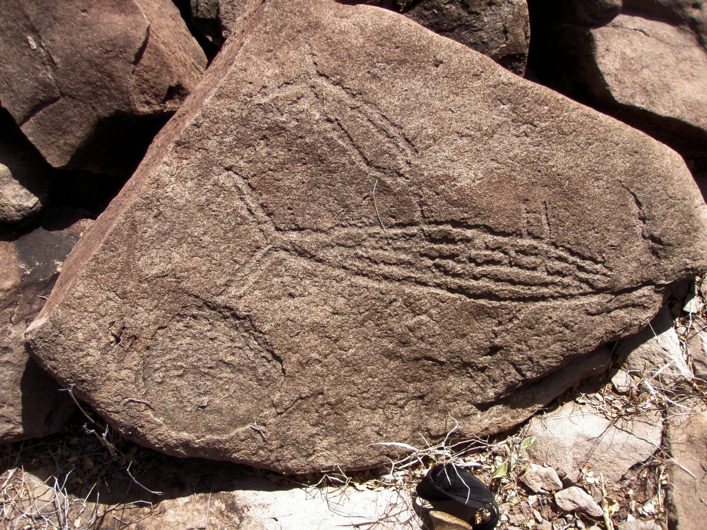
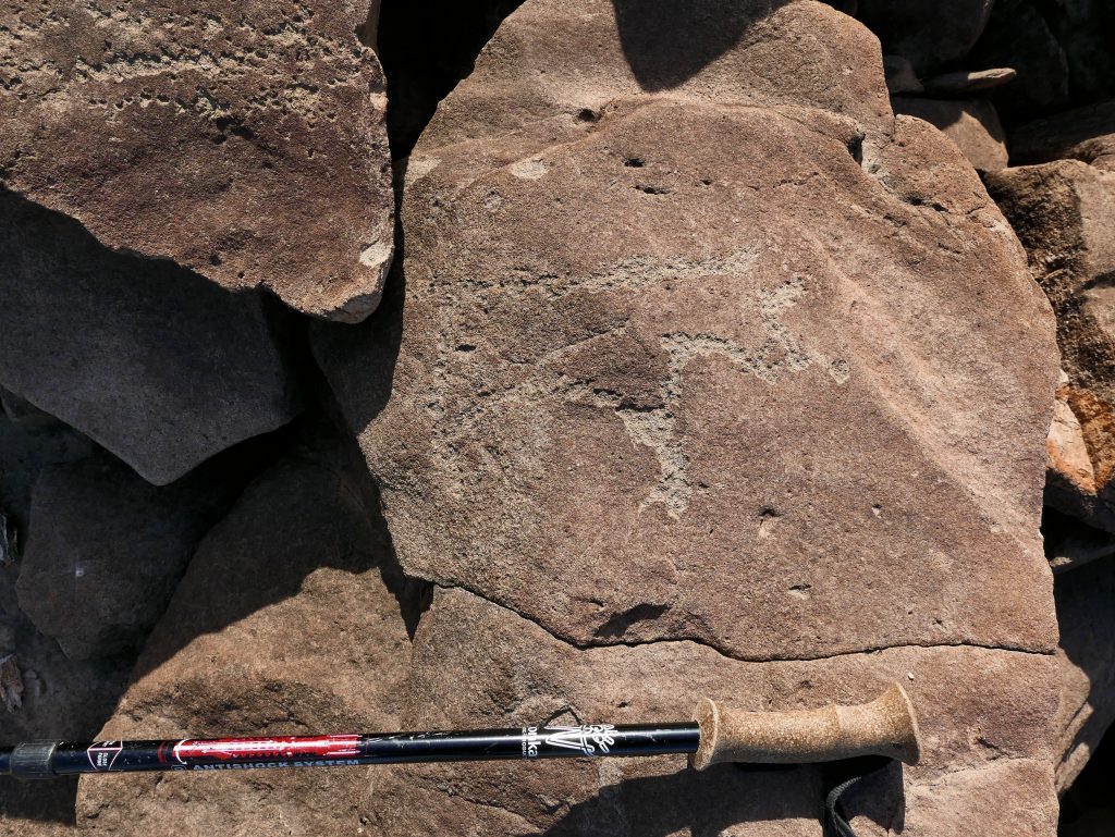
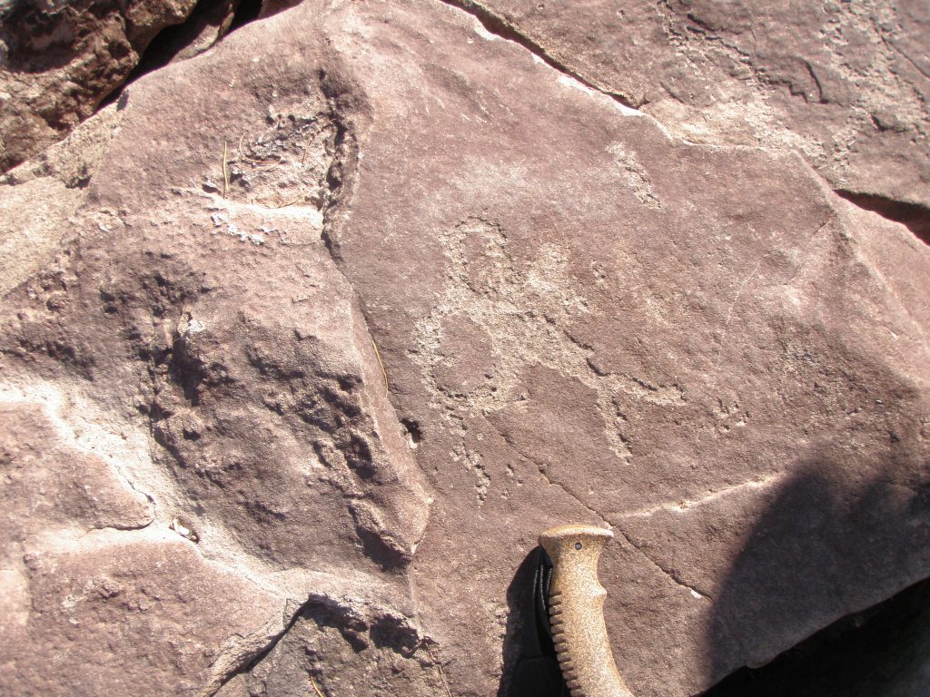
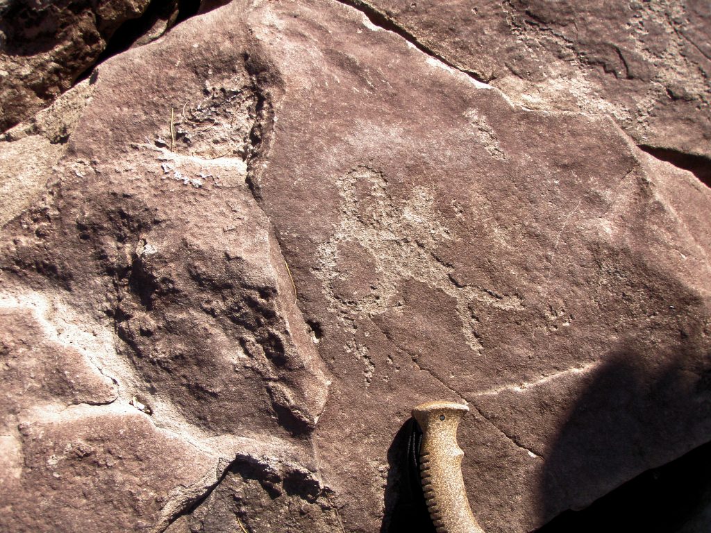
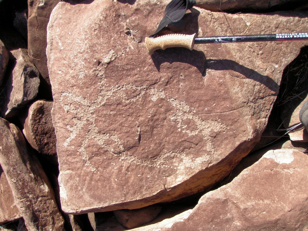
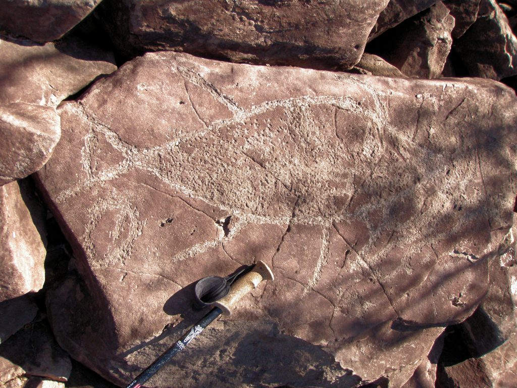
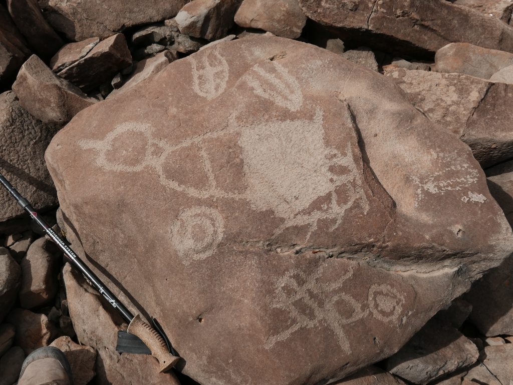
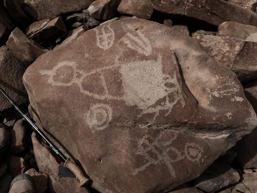
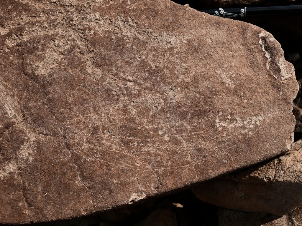
At the edge of one of the Habitation clearings is this petroglyph shown above. Some of the petroglyphs in this area are very old and judging by the darkness of the patina on the inscribed portions may have been between 10 and 15 thousand years before present and done by The “Ancients” a long time before the Cochimi came on the scene.
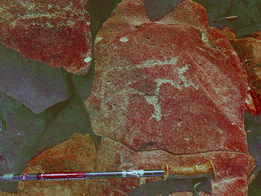
Another example of a heavily patinated petroglyph associated with the “Ancients”. This ‘Sun’ is the same diameter as the one in the above composition with the fish.
Discussion on Habitations: in every Habitation clearing, the patina on the rocks that had been moved to one side is noticeably darker than the patina of the exposed rocks left behind. You would expect that. None of the light coloured rocks had petroglyphs on them however. Also, the metate surfaces are quite light in colour with little patina. Again, one would expect this as the act of grinding the seeds would also grind away the rock surface and remove the dark patina. Therefore, I propose that many of the older petroglyphs with the dark patina were inscribed on the rocks before they were moved and that the rocks were moved many thousand of years after they were inscribed. Attributing the clearing of the Habitation surfaces and the use of the metates therein to the Cochimi and the inscribing of most of the older glyphs to a race of people that preceded them. . I have been calling these people the ‘Ancients’. This would further suggest that the Cochimi used this site for longer periods of time at each occurrence and therefore had need of Habitation clearings as per their culture. The previous tenants of the site however, did not stay in the area for a significant length of time or at least had no need of Habitation clearings in their culture.
From the above critical assumption, it then demands that a study of the petroglyphs at this site be done with a view to determining age and the style attributed to the Cochimi and their earlier “Ancient” co-habitants. Perhaps a method of differentiating between the two groups of petroglyphs can be found. From first impressions however I can see the following:
Earlier petroglyphs
* Deeply incised into the surface sometimes with quite wide lines
* Heavily patinated in both the pecked areas and surrounding rock surface.
* Predominately fish represented
* The fish tend to be narrow relative to length
* The fish tend to have internal laterally inscribed lines
* The fish tend to have prominent forked tails like a pompano
* No petroglyphs of deer evident
Later petroglyphs
* Tend to be shallow incised outlines and fairly narrow
* Incisions are not patinated or only very slightly so.
* Many different species of sea and land creatures realistically represented
* Humans or Shamans represented
* Abstract forms represented
* Some glyphs (especially here on the west side) have “aura” depicted around limbs and torso of humans. The Sea Goddess for example. (Noticed at Tres Ventanas cave in the San Juan arroyo too and may be made by same artist)
It might be possible to derive a scale of aging of the petroglyphs in this area by studying the degree of microerosion (as per Robert Bednarik in Australia) of the edges of the inscribed art. By microscopically examining the crystalline structure of the stone and noting the degree of waning of the crystals at the incised edge and comparing it to the structure of crystals at a natural (new) edge, a degree of difference could be noted. Also, there may be present in the structure of the rock, crystals that are solvent to atmospheric gasses that may indicate a degree of decay in the inscribed area different from decay in non-inscribed natural surfaces. However I doubt whether there has been a calibration curve proven to be correct for the mineral compounds in the rock in this geographic area. It might be a worthy study? Hmm.
The newer petroglyphs were mainly fish, but one Anthropomorph was found, a few turtles, a few vulvas and a couple of Porpoise representations. No birds. Many of the glyphs incorporated features in the rock and some of the figures had lines that continued over the edge of the rock onto another face or plane.
Now here is something strange. . .
There was one location about 250 meters from the start of the historical trail and towards the east side of the moraine, where the rocks were cleared from the ground and piled in two parallel lines about 4 meters wide and about 50 meters long leaving a relatively clear area in between. This Cochimi Road looks like it could have been made with a motor grader. Measuring with a compass the lines ran at about 315 degrees magnetic so they were not aligned to the North (or Pole) star. There were no easily visible petroglyphs at either end, nor were there any other prominent rock configurations at either end or close by. Part of a processional route? Hmm!
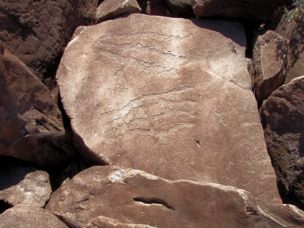
From the top of the moraine I cast about from side to side and spent a few hours quickly exploring to the southern edge of the moraine about 3/4 km away, and found no further indications of man made clearings. I expect this was due to the distance required to easily access water from the arroyo below. Traversing the edges of the moraine to the south and returning via the west edge, I came across occasional petroglyphs of fish. None however, that had the size or detail of the main petroglyphs on the west facing cliff.
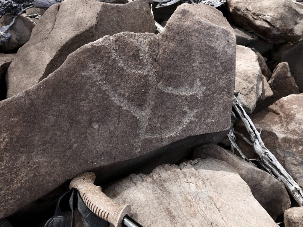
Here are a few of the petroglyphs that occur in the vicinity of the Habitation clearings.
A Coyote that may have an Atlatyl dart penetrating mid body.
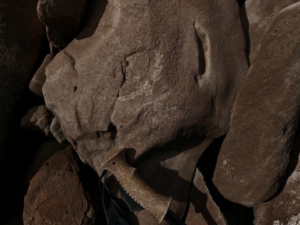
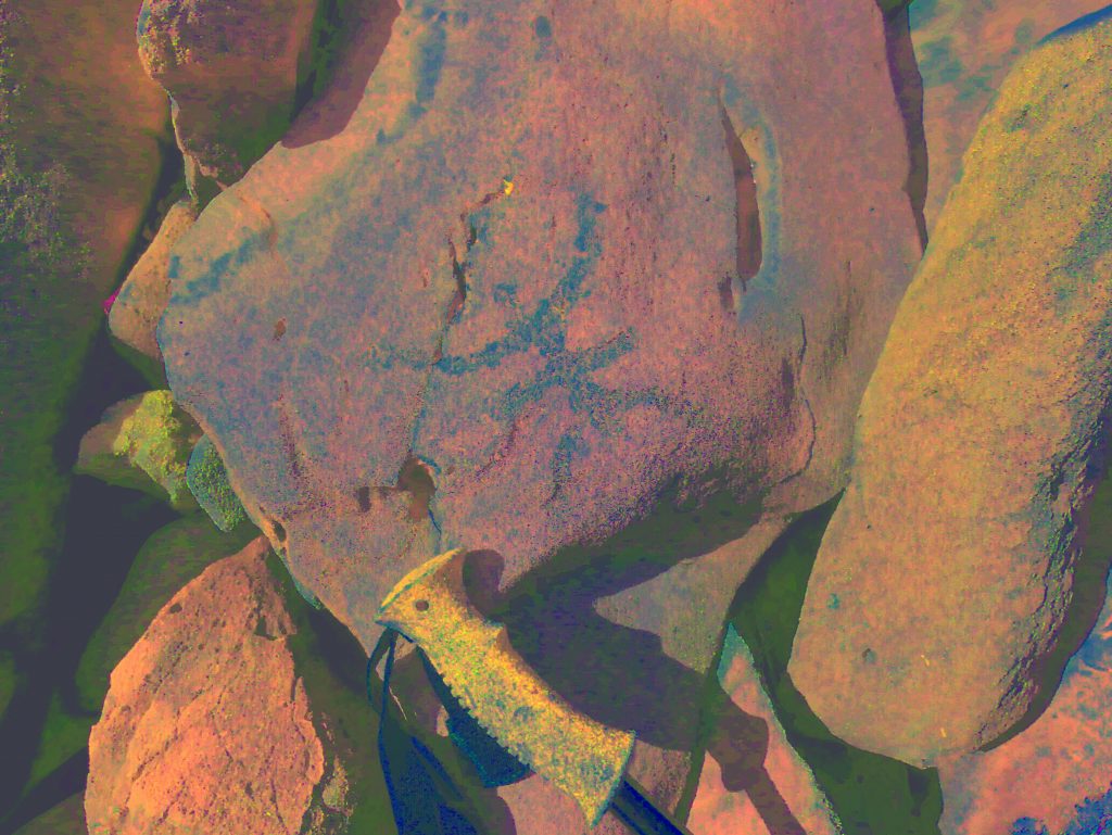
Anthropomorph with cross face. split in rock happened a long time ago (rounded edges) after the glyph was made?
Interesting glyph that combines a fish and vulva? How about testicles and penis with ejaculated matter? A few of these glyphs appears in more locations around here.
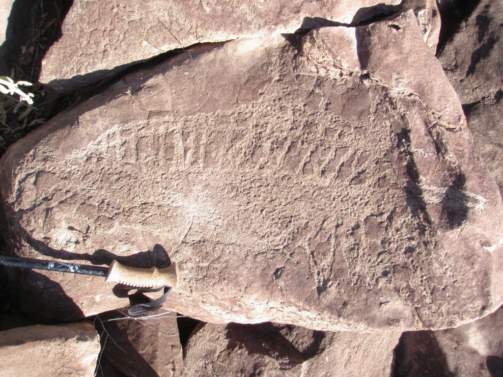
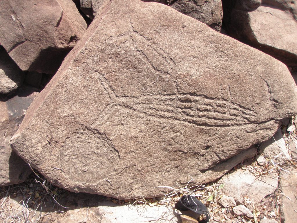
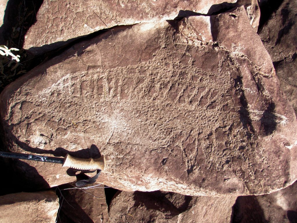
Very interesting, very old glyph which appears to be a dolphin that is partially sectioned showing internal bones and organs on one side, and outer view on the other. Pectoral fins bottom right, Dolphin snout at far right.
Turtle, about 25cms long, with head to left, patterns on shell near places where limbs protrude and perhaps an Atlatl dart or spear penetrating neck area from viewers bottom left. Very easy to miss this glyph. Very simple very neat! Note the different colour of patination and the sharper edges to the incisions compared to A20 “Sun and Fish” This glyph was made more recently in time.
Photo A 27+contrast by author
On left, Dolphin about 15cms long. On right, Fish and vulva depiction?
On left, creature with tail extending over edge of rock, no head? On right, large Jack or tuna fish with internal detail. Vulva symbol close by also.
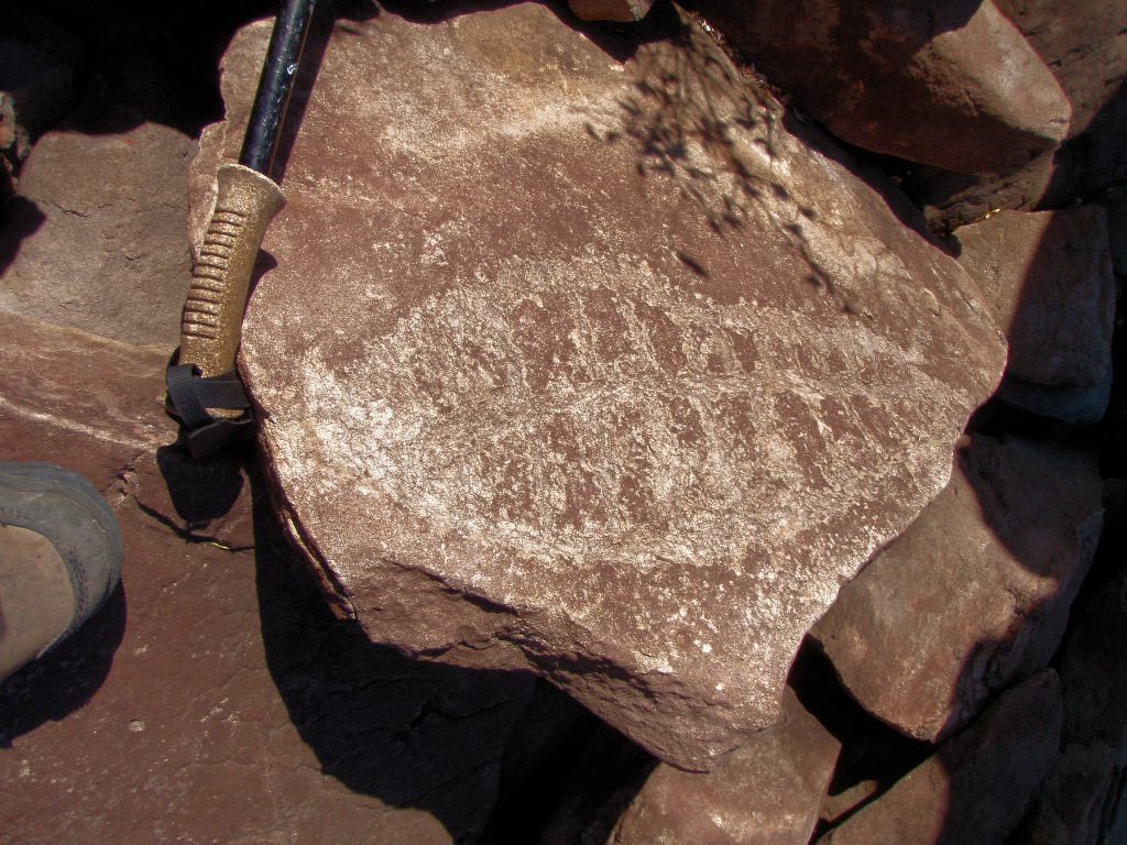
On left, heavily patinated fish type of creature showing internal bones? Wide inscribed lines. On right, two, four lined objects that look like bear paw scratches.
On left, Lizard Man with three toes and head extending onto top plane of rock. On right, abstract squid shaped object perhaps incorporating hole in rock to the right?
Random abstract glyphs on about 1 meter square rock. No patination.
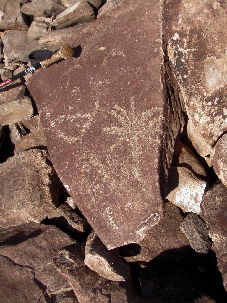
What’s this?
How about a rendition of a Supernova and Moon? Almost the same as at Chako Canyon. Depicting the event of the year 1054 which formed the Crab Nebula. Fairly wide lines, quite heavy patination. Now I’m getting excited! Same as Carl Sagan!
Photo A50+contrast by author
And look. . . some of the drawn lines of the starburst go over the edge of the rock onto another plane!
Photo A 51+contrast by author
What’s this?. . . A closer look reveals faint lines from the ‘moon’ in the form of a fish. . .making the ‘moon’ the tail of the fish. The artist never got to finish their work. Darn! . . . and the supernova could be a Palm Tree. The Blue Palm is indigenous to Baja. . . . but not as dramatic an explanation as a supernova! . . . so I want to stick with the supernova explanation! Oh well!
Photo A 52+contrast by author
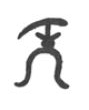
Something different to finish this page. An abstract glyph in the form of a chalice? or maybe a form of lizard man?
Just something to add to the above photos. . . Here is a sketch of a petroglyph done by Leon Diguet from the Canada de San Matilla in 1889. Do you see the similarity to the above glyph?